Mata Ie geodata
Mata Ie (Aceh) is a seat of a third-order administrative division; located in Indonesia in Asia/Jakarta (GMT+7) time zone. In our database, there are 407 cities with bigger population. Compared to other cities in Indonesia, 99.9% of cities are located further ↓South; 99.9% of cities are located further →East and 90.6% of cities have higher elevation than Mata Ie. Note1


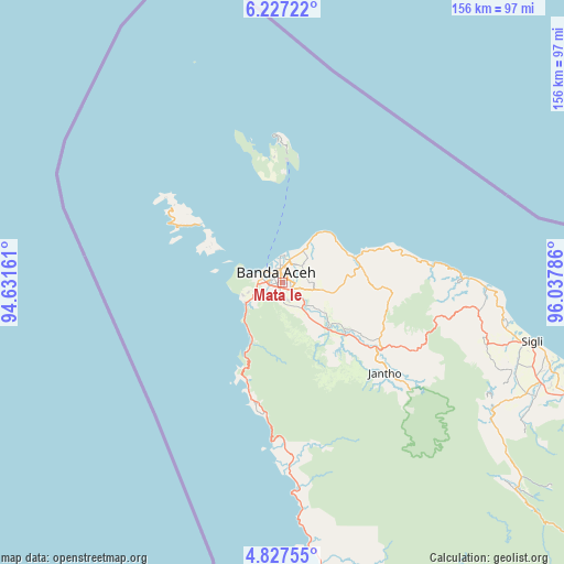
Mata Ie GPS coordinates[2]
5° 31' 40.08" North, 95° 20' 5.028" East
| Map corner | latitude | longitude |
|---|---|---|
| Upper-left | 6.22722°, | 94.63161° |
| Center: | 5.5278°, | 95.33473° |
| Lower-right: | 4.82755°, | 96.03786° |
| Map W x H: | 155.6×155.6 km | = 96.7×96.7mi |
| max Lat: | 5.88969° ⇑0.1% North |
| Mata Ie: | 5.5278° |
| min Lat: | ⇓99.9% South -10.934° |
| min Long | Mata Ie | max Long |
| 95.1345° | 95.33473° | 140.9419° |
| W 0.1%⇐ | ⇒99.9% E |
Elevation
Elevation of Mata Ie is 10 m = 33 ft, and this is 219.7 m = 721 ft below average elevation for this country.
| Max E: |
3185 m = 10449 ft | 90.6% |
| Avg. | 229.7 m = 754 ft | |
| Mata Ie | 10 m = 33 ft | |
Min E: |
-1 m = -3 ft | 9.4% |
See also: Indonesia elevation on elevation.city.
Geographical zone
Mata Ie is located in North Torrid zone (between Equator and Tropic of Cancer). Distance of Equator is 614.6 km =381.9 mi to South.| Distance of | km | miles | from Mata Ie |
|---|---|---|---|
| North Pole | 9392.4 | 5836.2 | to North |
| Arctic Circle | 6786.5 | 4216.9 | to North |
| Tropic Cancer | 1991.3 | 1237.3 | to North |
| Equator | 614.6 | 381.9 | to South |


Nearby cities:
15 places around Mata Ie: (largest is in red/bold)
• Angan
10.7 km =6.6 mi,  35°
35°
• Banda Aceh
1.5 km =0.9 mi,  354°
354°
• Indrapuri
10.7 km =6.6 mi,  121°
121°
• Kruengraya
21 km =13 mi,  70°
70°
• Lambaro
3.3 km =2.1 mi,  17°
17°
• Lampuuk
7.7 km =4.8 mi,  51°
51°
• Lampuyang
27.2 km =16.9 mi,  305°
305°
• Lhoknga
11.4 km =7.1 mi,  240°
240°
• Lhoong
30.5 km =19 mi,  197°
197°
• Luthu
25 km =15.5 mi,  162°
162°
• Montasik
10.2 km =6.3 mi,  105°
105°
• Peukanbada
11.8 km =7.3 mi,  274°
274°
• Sabang
40.3 km =25 mi,  357°
357°
• Seulimeum
32.5 km =20.2 mi, 124°
• Sibreh
4.4 km =2.7 mi,  103°
103°
Sources, notices
• [Note1] Compared only with cities in Indonesia existing in our database
• [Src1] Map data: © OpenStreetMap contributors (CC-BY-SA)
• [Src2] Other city data from geonames.org with taken over terms of usage.
• [Src3] Geographical zone / Annual Mean Temperature by Robert A. Rohde @ Wikipedia
