Blang Ara geodata
Blang Ara (Aceh) is a seat of a third-order administrative division; located in Indonesia in Asia/Jakarta (GMT+7) time zone. In our database, there are 407 cities with bigger population. Compared to other cities in Indonesia, 99.6% of cities are located further ↓South; 99.1% of cities are located further →East and 51.9% of cities have lower elevation than Blang Ara. Note1


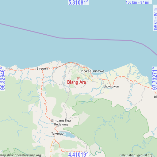
Blang Ara GPS coordinates[2]
5° 6' 39.168" North, 97° 1' 46.488" East
| Map corner | latitude | longitude |
|---|---|---|
| Upper-left | 5.81081°, | 96.32646° |
| Center: | 5.11088°, | 97.02958° |
| Lower-right: | 4.41019°, | 97.73271° |
| Map W x H: | 155.7×155.7 km | = 96.7×96.7mi |
| max Lat: | 5.88969° ⇑0.4% North |
| Blang Ara: | 5.11088° |
| min Lat: | ⇓99.6% South -10.934° |
| min Long | Blang Ara | max Long |
| 95.1345° | 97.02958° | 140.9419° |
| W 0.9%⇐ | ⇒99.1% E |
Elevation
Elevation of Blang Ara is 109 m = 358 ft, and this is 120.7 m = 396 ft below average elevation for this country.
| Max E: |
3185 m = 10449 ft | 48.1% |
| Avg. | 229.7 m = 754 ft | |
| Blang Ara | 109 m = 358 ft | |
Min E: |
-1 m = -3 ft | 51.9% |
See also: Indonesia elevation on elevation.city.
Geographical zone
Blang Ara is located in North Torrid zone (between Equator and Tropic of Cancer). Distance of Equator is 568.3 km =353.1 mi to South.| Distance of | km | miles | from Blang Ara |
|---|---|---|---|
| North Pole | 9438.8 | 5865 | to North |
| Arctic Circle | 6832.9 | 4245.8 | to North |
| Tropic Cancer | 2037.6 | 1266.1 | to North |
| Equator | 568.3 | 353.1 | to South |


Nearby cities:
15 places around Blang Ara: (largest is in red/bold)
• Adil Makmur
20.2 km =12.6 mi,  298°
298°
• Alue Glumpang
29.5 km =18.3 mi,  263°
263°
• Bireun
37.8 km =23.5 mi,  285°
285°
• Blang Mane
30.3 km =18.8 mi,  249°
249°
• Blangpulo
11.9 km =7.4 mi,  26°
26°
• Bulahblangaro
19.8 km =12.3 mi, 262°
• Cot Baroh
23.9 km =14.9 mi, 299°
• Juli
35.3 km =21.9 mi,  269°
269°
• Jumpangdua
28.8 km =17.9 mi, 289°
• Lhokseumawe
15.5 km =9.6 mi,  60°
60°
• Matangkuli
29.5 km =18.3 mi,  107°
107°
• Matangpayang
24.4 km =15.2 mi,  86°
86°
• Seunudon
47.7 km =29.6 mi,  76°
76°
• Simpang Teritit
49.8 km =30.9 mi,  202°
202°
• Simpang Tiga Redelong
46.5 km =28.9 mi, 201°
Sources, notices
• [Note1] Compared only with cities in Indonesia existing in our database
• [Src1] Map data: © OpenStreetMap contributors (CC-BY-SA)
• [Src2] Other city data from geonames.org with taken over terms of usage.
• [Src3] Geographical zone / Annual Mean Temperature by Robert A. Rohde @ Wikipedia
