Cot Baroh geodata
Cot Baroh (Aceh) is a seat of a third-order administrative division; located in Indonesia in Asia/Jakarta (GMT+7) time zone. In our database, there are 407 cities with bigger population. Compared to other cities in Indonesia, 99.7% of cities are located further ↓South; 99.2% of cities are located further →East and 95.5% of cities have higher elevation than Cot Baroh. Note1


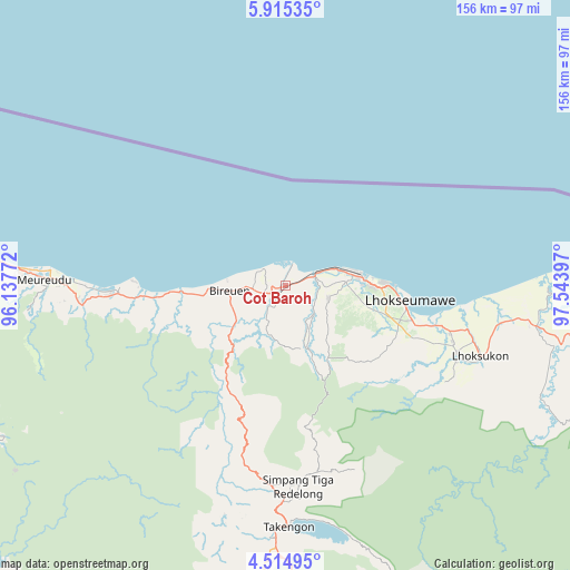
Cot Baroh GPS coordinates[2]
5° 12' 55.944" North, 96° 50' 27.024" East
| Map corner | latitude | longitude |
|---|---|---|
| Upper-left | 5.91535°, | 96.13772° |
| Center: | 5.21554°, | 96.84084° |
| Lower-right: | 4.51495°, | 97.54397° |
| Map W x H: | 155.7×155.7 km | = 96.7×96.7mi |
| max Lat: | 5.88969° ⇑0.3% North |
| Cot Baroh: | 5.21554° |
| min Lat: | ⇓99.7% South -10.934° |
| min Long | Cot Baroh | max Long |
| 95.1345° | 96.84084° | 140.9419° |
| W 0.8%⇐ | ⇒99.2% E |
Elevation
Elevation of Cot Baroh is 7 m = 23 ft, and this is 222.7 m = 731 ft below average elevation for this country.
| Max E: |
3185 m = 10449 ft | 95.5% |
| Avg. | 229.7 m = 754 ft | |
| Cot Baroh | 7 m = 23 ft | |
Min E: |
-1 m = -3 ft | 4.5% |
See also: Indonesia elevation on elevation.city.
Geographical zone
Cot Baroh is located in North Torrid zone (between Equator and Tropic of Cancer). Distance of Equator is 579.9 km =360.3 mi to South.| Distance of | km | miles | from Cot Baroh |
|---|---|---|---|
| North Pole | 9427.1 | 5857.7 | to North |
| Arctic Circle | 6821.3 | 4238.6 | to North |
| Tropic Cancer | 2026 | 1258.9 | to North |
| Equator | 579.9 | 360.3 | to South |


Nearby cities:
15 places around Cot Baroh: (largest is in red/bold)
• Adil Makmur
3.8 km =2.4 mi,  120°
120°
• Alue Glumpang
17.3 km =10.7 mi,  209°
209°
• Bireun
15.6 km =9.7 mi,  264°
264°
• Blang Ara
23.9 km =14.9 mi, 119°
• Blang Mane
23.3 km =14.5 mi,  199°
199°
• Blangpulo
26.2 km =16.3 mi,  92°
92°
• Bulahblangaro
14.4 km =8.9 mi,  174°
174°
• Juli
18.7 km =11.6 mi,  230°
230°
• Jumpangdua
6.6 km =4.1 mi,  251°
251°
• Lhokseumawe
34.5 km =21.4 mi,  96°
96°
• Matangkuli
53.1 km =33 mi,  112°
112°
• Matangpayang
46.3 km =28.8 mi, 102°
• Simpang Tiga Redelong
55 km =34.2 mi,  176°
176°
• Ulee Gle
56.9 km =35.4 mi,  268°
268°
• Uleeglee
54.6 km =33.9 mi, 267°
Sources, notices
• [Note1] Compared only with cities in Indonesia existing in our database
• [Src1] Map data: © OpenStreetMap contributors (CC-BY-SA)
• [Src2] Other city data from geonames.org with taken over terms of usage.
• [Src3] Geographical zone / Annual Mean Temperature by Robert A. Rohde @ Wikipedia
