Matangai geodata
Matangai (Central Kalimantan) is a seat of a third-order administrative division; located in Indonesia in Asia/Pontianak (GMT+7) time zone. In our database, there are 407 cities with bigger population. Compared to other cities in Indonesia, 92% of cities are located further ↓South; 69.6% of cities are located further ←West and 93.7% of cities have higher elevation than Matangai. Note1


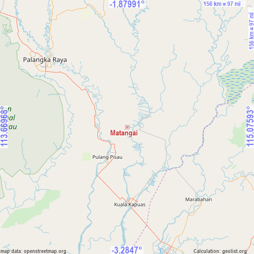
Matangai GPS coordinates[2]
2° 34' 57" South, 114° 22' 22.08" East
| Map corner | latitude | longitude |
|---|---|---|
| Upper-left | -1.87991°, | 113.66968° |
| Center: | -2.5825°, | 114.3728° |
| Lower-right: | -3.2847°, | 115.07593° |
| Map W x H: | 156.2×156.2 km | = 97.1×97.1mi |
| max Lat: | 5.88969° ⇑8% North |
| Matangai: | -2.5825° |
| min Lat: | ⇓92% South -10.934° |
| min Long | Matangai | max Long |
| 95.1345° | 114.3728° | 140.9419° |
| W 69.6%⇐ | ⇒30.4% E |
Elevation
Elevation of Matangai is 8 m = 26 ft, and this is 221.7 m = 727 ft below average elevation for this country.
| Max E: |
3185 m = 10449 ft | 93.7% |
| Avg. | 229.7 m = 754 ft | |
| Matangai | 8 m = 26 ft | |
Min E: |
-1 m = -3 ft | 6.3% |
See also: Indonesia elevation on elevation.city.
Geographical zone
Matangai is located in South Torrid zone (between Equator and Tropic of Capricorn). Distance of Equator is 287.1 km =178.4 mi to North.| Distance of | km | miles | from Matangai |
|---|---|---|---|
| Equator | 287.1 | 178.4 | to North |
| Tropic Capricorn | 2318.8 | 1440.8 | to South |
| Antarctic Circle | 7114 | 4420.4 | to South |
| South Pole | 9719.9 | 6039.7 | to South |


Nearby cities:
15 places around Matangai: (largest is in red/bold)
• Anjirmuara
71.7 km =44.6 mi,  162°
162°
• Anjirserapat
50.8 km =31.6 mi,  178°
178°
• Bantul
67 km =41.6 mi,  139°
139°
• Barimba
40.7 km =25.3 mi,  169°
169°
• Basarang
43.2 km =26.8 mi,  190°
190°
• Belawang
63.1 km =39.2 mi,  149°
149°
• Jenamas
61.3 km =38.1 mi,  75°
75°
• Kualakapuas
47.5 km =29.5 mi, 178°
• Marabahan
65 km =40.4 mi, 137°
• Mengkalip
74.3 km =46.2 mi,  49°
49°
• Palangkaraya
65.6 km =40.8 mi,  309°
309°
• Pulang Pisau
25.2 km =15.7 mi,  215°
215°
• Sungaigampa
66.6 km =41.4 mi, 146°
• Sungaipuntik
73.8 km =45.9 mi, 152°
• Sungaitatas
30.9 km =19.2 mi, 155°
Sources, notices
• [Note1] Compared only with cities in Indonesia existing in our database
• [Src1] Map data: © OpenStreetMap contributors (CC-BY-SA)
• [Src2] Other city data from geonames.org with taken over terms of usage.
• [Src3] Geographical zone / Annual Mean Temperature by Robert A. Rohde @ Wikipedia
