Palangkaraya geodata
Palangkaraya (Central Kalimantan) is a seat of a first-order administrative division; located in Indonesia in Asia/Pontianak (GMT+7) time zone. With population of 148,139 people, there are 78 cities with bigger population in this country. Compared to other cities in Indonesia, 92.6% of cities are located further ↓South; 66.6% of cities are located further ←West and 83% of cities have higher elevation than Palangkaraya. Note1


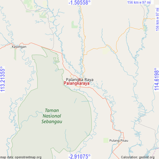
Palangkaraya GPS coordinates[2]
2° 12' 29.988" South, 113° 55' 0.012" East
| Map corner | latitude | longitude |
|---|---|---|
| Upper-left | -1.50558°, | 113.21355° |
| Center: | -2.20833°, | 113.91667° |
| Lower-right: | -2.91075°, | 114.6198° |
| Map W x H: | 156.2×156.2 km | = 97.1×97.1mi |
| max Lat: | 5.88969° ⇑7.4% North |
| Palangkaraya: | -2.20833° |
| min Lat: | ⇓92.6% South -10.934° |
| min Long | Palangkaraya | max Long |
| 95.1345° | 113.91667° | 140.9419° |
| W 66.6%⇐ | ⇒33.4% E |
Elevation
Elevation of Palangkaraya is 16 m = 52 ft, and this is 213.7 m = 701 ft below average elevation for this country.
| Max E: |
3185 m = 10449 ft | 83% |
| Avg. | 229.7 m = 754 ft | |
| Palangkaraya | 16 m = 52 ft | |
Min E: |
-1 m = -3 ft | 17% |
See also: Palangkaraya elevation on elevation.city.
Geographical zone
Palangkaraya is located in South Torrid zone (between Equator and Tropic of Capricorn). Distance of Equator is 245.5 km =152.5 mi to North.| Distance of | km | miles | from Palangkaraya |
|---|---|---|---|
| Equator | 245.5 | 152.5 | to North |
| Tropic Capricorn | 2360.4 | 1466.7 | to South |
| Antarctic Circle | 7155.6 | 4446.3 | to South |
| South Pole | 9761.5 | 6065.5 | to South |


Nearby cities:
15 places around Palangkaraya: (largest is in red/bold)
• Anjirserapat
106 km =65.9 mi,  150°
150°
• Barimba
100.3 km =62.3 mi,  144°
144°
• Basarang
94.1 km =58.5 mi, 153°
• Belawang
126.6 km =78.7 mi, 139°
• Buntok
116 km =72.1 mi,  62°
62°
• Jenamas
113.3 km =70.4 mi,  103°
103°
• Kotabesi
103.2 km =64.1 mi,  259°
259°
• Kualakapuas
103.3 km =64.2 mi, 149°
• Matangai
65.6 km =40.8 mi,  129°
129°
• Mengkalip
107.5 km =66.8 mi,  86°
86°
• Petakbehandang
55.3 km =34.4 mi,  285°
285°
• Pulang Pisau
71.8 km =44.6 mi, 149°
• Sampit
113.3 km =70.4 mi,  251°
251°
• Sungaitatas
94.3 km =58.6 mi, 137°
• Tongkiling
9.3 km =5.8 mi,  330°
330°
Sources, notices
• [Note1] Compared only with cities in Indonesia existing in our database
• [Src1] Map data: © OpenStreetMap contributors (CC-BY-SA)
• [Src2] Other city data from geonames.org with taken over terms of usage.
• [Src3] Geographical zone / Annual Mean Temperature by Robert A. Rohde @ Wikipedia
