Lotu geodata
Lotu (North Sumatra) is a seat of a second-order administrative division; located in Indonesia in Asia/Jakarta (GMT+7) time zone. In our database, there are 407 cities with bigger population. Compared to other cities in Indonesia, 96.6% of cities are located further ↓South; 98.9% of cities are located further →East and 85.2% of cities have higher elevation than Lotu. Note1


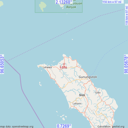
Lotu GPS coordinates[2]
1° 25' 47.64" North, 97° 21' 13.14" East
| Map corner | latitude | longitude |
|---|---|---|
| Upper-left | 2.13268°, | 96.65053° |
| Center: | 1.4299°, | 97.35365° |
| Lower-right: | 0.7269°, | 98.05678° |
| Map W x H: | 156.3×156.3 km | = 97.1×97.1mi |
| max Lat: | 5.88969° ⇑3.4% North |
| Lotu: | 1.4299° |
| min Lat: | ⇓96.6% South -10.934° |
| min Long | Lotu | max Long |
| 95.1345° | 97.35365° | 140.9419° |
| W 1.1%⇐ | ⇒98.9% E |
Elevation
Elevation of Lotu is 14 m = 46 ft, and this is 215.7 m = 708 ft below average elevation for this country.
| Max E: |
3185 m = 10449 ft | 85.2% |
| Avg. | 229.7 m = 754 ft | |
| Lotu | 14 m = 46 ft | |
Min E: |
-1 m = -3 ft | 14.8% |
See also: Indonesia elevation on elevation.city.
Geographical zone
Lotu is located in North Torrid zone (between Equator and Tropic of Cancer). Distance of Equator is 159 km =98.8 mi to South.| Distance of | km | miles | from Lotu |
|---|---|---|---|
| North Pole | 9848.1 | 6119.3 | to North |
| Arctic Circle | 7242.2 | 4500.1 | to North |
| Tropic Cancer | 2446.9 | 1520.4 | to North |
| Equator | 159 | 98.8 | to South |


Nearby cities:
15 places around Lotu: (largest is in red/bold)
• Barus
132.8 km =82.5 mi,  60°
60°
• Danauparis
136.1 km =84.6 mi,  36°
36°
• Gosong Telaga
113.9 km =70.8 mi,  34°
34°
• Gunungsitoli
32.9 km =20.4 mi,  118°
118°
• Kuala Baru
102.9 km =63.9 mi, 27°
• Kuala Baru Sungai
116.9 km =72.6 mi,  21°
21°
• Labuhan Bajau
147.1 km =91.4 mi,  317°
317°
• Onolimbu
51 km =31.7 mi,  161°
161°
• Pakkat
148.2 km =92.1 mi, 57°
• Pasir Panjang
155.9 km =96.9 mi, 27°
• Pulo Batal
89.4 km =55.6 mi,  351°
351°
• Rimo
123.4 km =76.7 mi, 33°
• Rundeng
149.5 km =92.9 mi, 20°
• Singkil
106.9 km =66.4 mi, 26°
• Teluk Dalam
107.6 km =66.9 mi,  152°
152°
Sources, notices
• [Note1] Compared only with cities in Indonesia existing in our database
• [Src1] Map data: © OpenStreetMap contributors (CC-BY-SA)
• [Src2] Other city data from geonames.org with taken over terms of usage.
• [Src3] Geographical zone / Annual Mean Temperature by Robert A. Rohde @ Wikipedia
