Labuhan Bajau geodata
Labuhan Bajau (Aceh) is a seat of a third-order administrative division; located in Indonesia in Asia/Jakarta (GMT+7) time zone. In our database, there are 407 cities with bigger population. Compared to other cities in Indonesia, 97.5% of cities are located further ↓South; 99.4% of cities are located further →East and 62.8% of cities have higher elevation than Labuhan Bajau. Note1


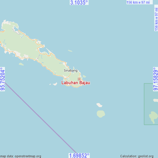
Labuhan Bajau GPS coordinates[2]
2° 24' 4.284" North, 96° 27' 18.576" East
| Map corner | latitude | longitude |
|---|---|---|
| Upper-left | 3.1035°, | 95.75204° |
| Center: | 2.40119°, | 96.45516° |
| Lower-right: | 1.69852°, | 97.15829° |
| Map W x H: | 156.2×156.2 km | = 97.1×97.1mi |
| max Lat: | 5.88969° ⇑2.5% North |
| Labuhan Bajau: | 2.40119° |
| min Lat: | ⇓97.5% South -10.934° |
| min Long | Labuhan Bajau | max Long |
| 95.1345° | 96.45516° | 140.9419° |
| W 0.6%⇐ | ⇒99.4% E |
Elevation
Elevation of Labuhan Bajau is 49 m = 161 ft, and this is 180.7 m = 593 ft below average elevation for this country.
| Max E: |
3185 m = 10449 ft | 62.8% |
| Avg. | 229.7 m = 754 ft | |
| Labuhan Bajau | 49 m = 161 ft | |
Min E: |
-1 m = -3 ft | 37.2% |
See also: Indonesia elevation on elevation.city.
Geographical zone
Labuhan Bajau is located in North Torrid zone (between Equator and Tropic of Cancer). Distance of Equator is 267 km =165.9 mi to South.| Distance of | km | miles | from Labuhan Bajau |
|---|---|---|---|
| North Pole | 9740.1 | 6052.2 | to North |
| Arctic Circle | 7134.2 | 4433 | to North |
| Tropic Cancer | 2338.9 | 1453.3 | to North |
| Equator | 267 | 165.9 | to South |


Nearby cities:
15 places around Labuhan Bajau: (largest is in red/bold)
• Bakungan
128.1 km =79.6 mi,  63°
63°
• Kuala Baru Sungai
142.8 km =88.7 mi,  89°
89°
• Lauke
50.3 km =31.3 mi,  293°
293°
• Luan Balu
19.5 km =12.1 mi,  315°
315°
• Meukek
137.2 km =85.3 mi,  29°
29°
• Paya Dapur
139.7 km =86.8 mi,  49°
49°
• Peuleumat
140.6 km =87.4 mi, 27°
• Pulo Batal
88.7 km =55.1 mi,  102°
102°
• Pulo Ie
139.9 km =86.9 mi, 45°
• Samadua
128.2 km =79.7 mi,  35°
35°
• Sawang
132.5 km =82.3 mi, 32°
• Sibigo
77.4 km =48.1 mi,  308°
308°
• Sinabang
12.1 km =7.5 mi, 316°
• Suak Bakung
121.3 km =75.4 mi, 56°
• Terbangan
128.1 km =79.6 mi, 45°
Sources, notices
• [Note1] Compared only with cities in Indonesia existing in our database
• [Src1] Map data: © OpenStreetMap contributors (CC-BY-SA)
• [Src2] Other city data from geonames.org with taken over terms of usage.
• [Src3] Geographical zone / Annual Mean Temperature by Robert A. Rohde @ Wikipedia
