Lhokkruet geodata
Lhokkruet (Aceh) is a seat of a third-order administrative division; located in Indonesia in Asia/Jakarta (GMT+7) time zone. In our database, there are 407 cities with bigger population. Compared to other cities in Indonesia, 99.4% of cities are located further ↓South; 99.9% of cities are located further →East and 97.2% of cities have higher elevation than Lhokkruet. Note1


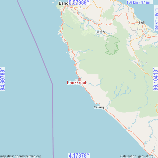
Lhokkruet GPS coordinates[2]
4° 52' 46.92" North, 95° 24' 3.6" East
| Map corner | latitude | longitude |
|---|---|---|
| Upper-left | 5.57989°, | 94.69788° |
| Center: | 4.8797°, | 95.401° |
| Lower-right: | 4.17878°, | 96.10413° |
| Map W x H: | 155.8×155.8 km | = 96.8×96.8mi |
| max Lat: | 5.88969° ⇑0.6% North |
| Lhokkruet: | 4.8797° |
| min Lat: | ⇓99.4% South -10.934° |
| min Long | Lhokkruet | max Long |
| 95.1345° | 95.401° | 140.9419° |
| W 0.1%⇐ | ⇒99.9% E |
Elevation
Elevation of Lhokkruet is 6 m = 20 ft, and this is 223.7 m = 734 ft below average elevation for this country.
| Max E: |
3185 m = 10449 ft | 97.2% |
| Avg. | 229.7 m = 754 ft | |
| Lhokkruet | 6 m = 20 ft | |
Min E: |
-1 m = -3 ft | 2.8% |
See also: Indonesia elevation on elevation.city.
Geographical zone
Lhokkruet is located in North Torrid zone (between Equator and Tropic of Cancer). Distance of Equator is 542.6 km =337.2 mi to South.| Distance of | km | miles | from Lhokkruet |
|---|---|---|---|
| North Pole | 9464.5 | 5881 | to North |
| Arctic Circle | 6858.6 | 4261.7 | to North |
| Tropic Cancer | 2063.3 | 1282.1 | to North |
| Equator | 542.6 | 337.2 | to South |


Nearby cities:
15 places around Lhokkruet: (largest is in red/bold)
• Blang Dalam
24.3 km =15.1 mi,  85°
85°
• Calang
33.8 km =21 mi,  145°
145°
• Indrapuri
66.4 km =41.3 mi,  1°
1°
• Kalde Panga
50.1 km =31.1 mi,  135°
135°
• Keumala
71 km =44.1 mi,  54°
54°
• Lageun
25.2 km =15.7 mi, 145°
• Lamno
23.6 km =14.7 mi,  352°
352°
• Lhoknga
68.6 km =42.6 mi, 345°
• Lhoong
46.2 km =28.7 mi,  338°
338°
• Luthu
48.2 km =30 mi, 0°
• Mane
67.4 km =41.9 mi,  84°
84°
• Montasik
69.3 km =43.1 mi, 2°
• Seulimeum
57 km =35.4 mi,  19°
19°
• Tangse
58.9 km =36.6 mi, 75°
• Tiro
68.7 km =42.7 mi,  59°
59°
Sources, notices
• [Note1] Compared only with cities in Indonesia existing in our database
• [Src1] Map data: © OpenStreetMap contributors (CC-BY-SA)
• [Src2] Other city data from geonames.org with taken over terms of usage.
• [Src3] Geographical zone / Annual Mean Temperature by Robert A. Rohde @ Wikipedia
