Lamno geodata
Lamno (Aceh) is a seat of a third-order administrative division; located in Indonesia in Asia/Jakarta (GMT+7) time zone. In our database, there are 407 cities with bigger population. Compared to other cities in Indonesia, 99.5% of cities are located further ↓South; 99.9% of cities are located further →East and 89% of cities have higher elevation than Lamno. Note1


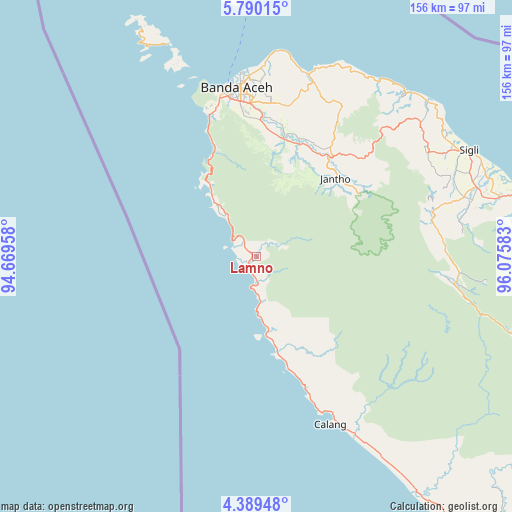
Lamno GPS coordinates[2]
5° 5' 24.72" North, 95° 22' 21.72" East
| Map corner | latitude | longitude |
|---|---|---|
| Upper-left | 5.79015°, | 94.66958° |
| Center: | 5.0902°, | 95.3727° |
| Lower-right: | 4.38948°, | 96.07583° |
| Map W x H: | 155.7×155.7 km | = 96.7×96.7mi |
| max Lat: | 5.88969° ⇑0.5% North |
| Lamno: | 5.0902° |
| min Lat: | ⇓99.5% South -10.934° |
| min Long | Lamno | max Long |
| 95.1345° | 95.3727° | 140.9419° |
| W 0.1%⇐ | ⇒99.9% E |
Elevation
Elevation of Lamno is 11 m = 36 ft, and this is 218.7 m = 718 ft below average elevation for this country.
| Max E: |
3185 m = 10449 ft | 89% |
| Avg. | 229.7 m = 754 ft | |
| Lamno | 11 m = 36 ft | |
Min E: |
-1 m = -3 ft | 11% |
See also: Indonesia elevation on elevation.city.
Geographical zone
Lamno is located in North Torrid zone (between Equator and Tropic of Cancer). Distance of Equator is 566 km =351.7 mi to South.| Distance of | km | miles | from Lamno |
|---|---|---|---|
| North Pole | 9441.1 | 5866.4 | to North |
| Arctic Circle | 6835.2 | 4247.2 | to North |
| Tropic Cancer | 2039.9 | 1267.5 | to North |
| Equator | 566 | 351.7 | to South |


Nearby cities:
15 places around Lamno: (largest is in red/bold)
• Banda Aceh
50.4 km =31.3 mi,  355°
355°
• Blang Dalam
34.8 km =21.6 mi,  128°
128°
• Indrapuri
43.3 km =26.9 mi,  6°
6°
• Lageun
47.4 km =29.5 mi,  158°
158°
• Lambaro
51.9 km =32.2 mi, 356°
• Lampuuk
53.5 km =33.2 mi,  1°
1°
• Lhokkruet
23.6 km =14.7 mi,  172°
172°
• Lhoknga
45.2 km =28.1 mi,  341°
341°
• Lhoong
23.9 km =14.9 mi,  325°
325°
• Luthu
25.1 km =15.6 mi, 7°
• Mata Ie
48.8 km =30.3 mi, 355°
• Montasik
46.2 km =28.7 mi, 6°
• Peukanbada
52.1 km =32.4 mi, 342°
• Seulimeum
37.7 km =23.4 mi,  36°
36°
• Sibreh
47.6 km =29.6 mi, 0°
Sources, notices
• [Note1] Compared only with cities in Indonesia existing in our database
• [Src1] Map data: © OpenStreetMap contributors (CC-BY-SA)
• [Src2] Other city data from geonames.org with taken over terms of usage.
• [Src3] Geographical zone / Annual Mean Temperature by Robert A. Rohde @ Wikipedia
