Kalde Panga geodata
Kalde Panga (Aceh) is a seat of a third-order administrative division; located in Indonesia in Asia/Jakarta (GMT+7) time zone. In our database, there are 407 cities with bigger population. Compared to other cities in Indonesia, 99.2% of cities are located further ↓South; 99.8% of cities are located further →East and 98.5% of cities have higher elevation than Kalde Panga. Note1


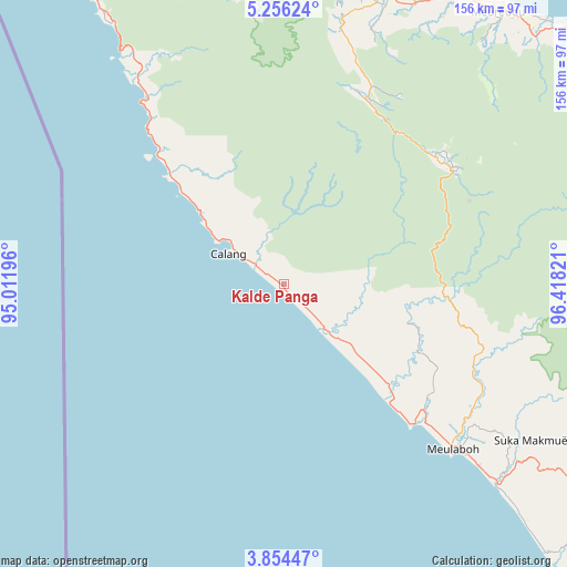
Kalde Panga GPS coordinates[2]
4° 33' 20.52" North, 95° 42' 54.288" East
| Map corner | latitude | longitude |
|---|---|---|
| Upper-left | 5.25624°, | 95.01196° |
| Center: | 4.5557°, | 95.71508° |
| Lower-right: | 3.85447°, | 96.41821° |
| Map W x H: | 155.9×155.9 km | = 96.9×96.9mi |
| max Lat: | 5.88969° ⇑0.8% North |
| Kalde Panga: | 4.5557° |
| min Lat: | ⇓99.2% South -10.934° |
| min Long | Kalde Panga | max Long |
| 95.1345° | 95.71508° | 140.9419° |
| W 0.2%⇐ | ⇒99.8% E |
Elevation
Elevation of Kalde Panga is 5 m = 16 ft, and this is 224.7 m = 737 ft below average elevation for this country.
| Max E: |
3185 m = 10449 ft | 98.5% |
| Avg. | 229.7 m = 754 ft | |
| Kalde Panga | 5 m = 16 ft | |
Min E: |
-1 m = -3 ft | 1.5% |
See also: Indonesia elevation on elevation.city.
Geographical zone
Kalde Panga is located in North Torrid zone (between Equator and Tropic of Cancer). Distance of Equator is 506.5 km =314.7 mi to South.| Distance of | km | miles | from Kalde Panga |
|---|---|---|---|
| North Pole | 9500.5 | 5903.3 | to North |
| Arctic Circle | 6894.6 | 4284.1 | to North |
| Tropic Cancer | 2099.4 | 1304.5 | to North |
| Equator | 506.5 | 314.7 | to South |


Nearby cities:
15 places around Kalde Panga: (largest is in red/bold)
• Banda Layung
54.9 km =34.1 mi,  129°
129°
• Blang Dalam
39.3 km =24.4 mi,  344°
344°
• Calang
17.6 km =10.9 mi,  298°
298°
• Drien Rampak
38.3 km =23.8 mi,  135°
135°
• Geumpang
58 km =36 mi,  58°
58°
• Kajeung
46.5 km =28.9 mi,  95°
95°
• Keudee Aron
63.9 km =39.7 mi, 126°
• Kuala Bhee
41.4 km =25.7 mi,  117°
117°
• Lageun
25.6 km =15.9 mi,  306°
306°
• Lhokkruet
50.1 km =31.1 mi,  315°
315°
• Mane
53.4 km =33.2 mi,  37°
37°
• Meulaboh
64.6 km =40.1 mi, 135°
• Meureubo
67.8 km =42.1 mi, 132°
• Pantai Ceuremen
57.2 km =35.5 mi,  111°
111°
• Tangse
55.5 km =34.5 mi,  23°
23°
Sources, notices
• [Note1] Compared only with cities in Indonesia existing in our database
• [Src1] Map data: © OpenStreetMap contributors (CC-BY-SA)
• [Src2] Other city data from geonames.org with taken over terms of usage.
• [Src3] Geographical zone / Annual Mean Temperature by Robert A. Rohde @ Wikipedia
