Tana Paser geodata
Tana Paser (East Kalimantan) is a seat of a second-order administrative division; located in Indonesia in Asia/Makassar (GMT+8) time zone. In our database, there are 407 cities with bigger population. Compared to other cities in Indonesia, 93% of cities are located further ↓South; 76.3% of cities are located further ←West and 98.5% of cities have higher elevation than Tana Paser. Note1


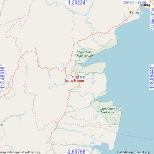
Tana Paser GPS coordinates[2]
1° 54' 18.36" South, 116° 11' 28.68" East
| Map corner | latitude | longitude |
|---|---|---|
| Upper-left | -1.20224°, | 115.48818° |
| Center: | -1.9051°, | 116.1913° |
| Lower-right: | -2.60768°, | 116.89443° |
| Map W x H: | 156.3×156.3 km | = 97.1×97.1mi |
| max Lat: | 5.88969° ⇑7% North |
| Tana Paser: | -1.9051° |
| min Lat: | ⇓93% South -10.934° |
| min Long | Tana Paser | max Long |
| 95.1345° | 116.1913° | 140.9419° |
| W 76.3%⇐ | ⇒23.7% E |
Elevation
Elevation of Tana Paser is 5 m = 16 ft, and this is 224.7 m = 737 ft below average elevation for this country.
| Max E: |
3185 m = 10449 ft | 98.5% |
| Avg. | 229.7 m = 754 ft | |
| Tana Paser | 5 m = 16 ft | |
Min E: |
-1 m = -3 ft | 1.5% |
See also: Indonesia elevation on elevation.city.
Geographical zone
Tana Paser is located in South Torrid zone (between Equator and Tropic of Capricorn). Distance of Equator is 211.8 km =131.6 mi to North.| Distance of | km | miles | from Tana Paser |
|---|---|---|---|
| Equator | 211.8 | 131.6 | to North |
| Tropic Capricorn | 2394.1 | 1487.6 | to South |
| Antarctic Circle | 7189.3 | 4467.2 | to South |
| South Pole | 9795.2 | 6086.5 | to South |


Nearby cities:
15 places around Tana Paser: (largest is in red/bold)
• Bakau
56.4 km =35 mi,  174°
174°
• Batusopang
32.3 km =20.1 mi,  286°
286°
• Gunungbatubesar
80.4 km =50 mi, 171°
• Halong
71.7 km =44.6 mi,  236°
236°
• Haruai
77 km =47.8 mi,  260°
260°
• Juai
82.8 km =51.4 mi, 237°
• Kerang
38.8 km =24.1 mi,  199°
199°
• Kuaro
15.6 km =9.7 mi,  307°
307°
• Longikis
35.8 km =22.2 mi,  2°
2°
• Longkali
45 km =28 mi,  18°
18°
• Manunggulama
67.8 km =42.1 mi,  182°
182°
• Muarakomam
49 km =30.4 mi,  300°
300°
• Muarauya
66.3 km =41.2 mi,  271°
271°
• Mungkuruyam
79.3 km =49.3 mi, 239°
• Tanjungsamalantakan
79.1 km =49.2 mi,  162°
162°
Sources, notices
• [Note1] Compared only with cities in Indonesia existing in our database
• [Src1] Map data: © OpenStreetMap contributors (CC-BY-SA)
• [Src2] Other city data from geonames.org with taken over terms of usage.
• [Src3] Geographical zone / Annual Mean Temperature by Robert A. Rohde @ Wikipedia
