Muarakomam geodata
Muarakomam (East Kalimantan) is a seat of a third-order administrative division; located in Indonesia in Asia/Makassar (GMT+8) time zone. In our database, there are 407 cities with bigger population. Compared to other cities in Indonesia, 93.3% of cities are located further ↓South; 75.8% of cities are located further ←West and 55.5% of cities have higher elevation than Muarakomam. Note1


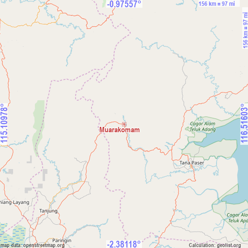
Muarakomam GPS coordinates[2]
1° 40' 42.6" South, 115° 48' 46.44" East
| Map corner | latitude | longitude |
|---|---|---|
| Upper-left | -0.97557°, | 115.10978° |
| Center: | -1.6785°, | 115.8129° |
| Lower-right: | -2.38118°, | 116.51603° |
| Map W x H: | 156.3×156.3 km | = 97.1×97.1mi |
| max Lat: | 5.88969° ⇑6.7% North |
| Muarakomam: | -1.6785° |
| min Lat: | ⇓93.3% South -10.934° |
| min Long | Muarakomam | max Long |
| 95.1345° | 115.8129° | 140.9419° |
| W 75.8%⇐ | ⇒24.2% E |
Elevation
Elevation of Muarakomam is 82 m = 269 ft, and this is 147.7 m = 485 ft below average elevation for this country.
| Max E: |
3185 m = 10449 ft | 55.5% |
| Avg. | 229.7 m = 754 ft | |
| Muarakomam | 82 m = 269 ft | |
Min E: |
-1 m = -3 ft | 44.5% |
See also: Indonesia elevation on elevation.city.
Geographical zone
Muarakomam is located in South Torrid zone (between Equator and Tropic of Capricorn). Distance of Equator is 186.6 km =115.9 mi to North.| Distance of | km | miles | from Muarakomam |
|---|---|---|---|
| Equator | 186.6 | 115.9 | to North |
| Tropic Capricorn | 2419.3 | 1503.3 | to South |
| Antarctic Circle | 7214.5 | 4482.9 | to South |
| South Pole | 9820.4 | 6102.1 | to South |


Nearby cities:
15 places around Muarakomam: (largest is in red/bold)
• Batusopang
19.6 km =12.2 mi,  145°
145°
• Halong
66.9 km =41.6 mi,  195°
195°
• Haruai
50.6 km =31.4 mi,  222°
222°
• Juai
75 km =46.6 mi, 201°
• Kelua
74.4 km =46.2 mi, 218°
• Kerang
68.1 km =42.3 mi, 154°
• Kuaro
33.6 km =20.9 mi,  117°
117°
• Longikis
45 km =28 mi,  76°
76°
• Longkali
59 km =36.7 mi,  72°
72°
• Muarauya
33.6 km =20.9 mi,  226°
226°
• Mungkuruyam
70.5 km =43.8 mi, 201°
• Paringin
82.2 km =51.1 mi,  207°
207°
• Tana Paser
49 km =30.4 mi, 120°
• Tanjung
70.9 km =44.1 mi, 219°
• Tanta
73.1 km =45.4 mi, 213°
Sources, notices
• [Note1] Compared only with cities in Indonesia existing in our database
• [Src1] Map data: © OpenStreetMap contributors (CC-BY-SA)
• [Src2] Other city data from geonames.org with taken over terms of usage.
• [Src3] Geographical zone / Annual Mean Temperature by Robert A. Rohde @ Wikipedia
