Sungsang geodata
Sungsang (South Sumatra) is a seat of a third-order administrative division; located in Indonesia in Asia/Jakarta (GMT+7) time zone. In our database, there are 407 cities with bigger population. Compared to other cities in Indonesia, 92.5% of cities are located further ↓South; 94.6% of cities are located further →East and 97.2% of cities have higher elevation than Sungsang. Note1


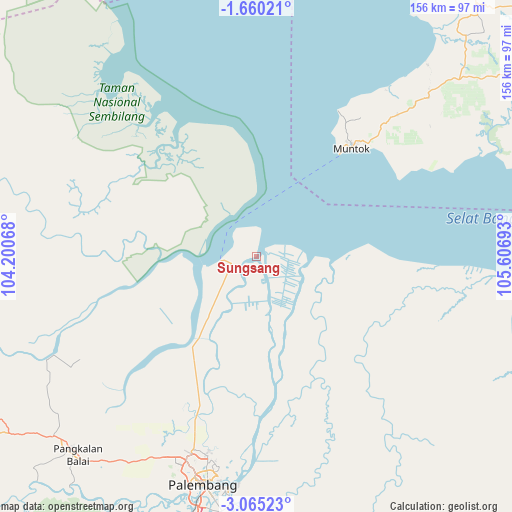
Sungsang GPS coordinates[2]
2° 21' 46.44" South, 104° 54' 13.68" East
| Map corner | latitude | longitude |
|---|---|---|
| Upper-left | -1.66021°, | 104.20068° |
| Center: | -2.3629°, | 104.9038° |
| Lower-right: | -3.06523°, | 105.60693° |
| Map W x H: | 156.2×156.2 km | = 97.1×97.1mi |
| max Lat: | 5.88969° ⇑7.5% North |
| Sungsang: | -2.3629° |
| min Lat: | ⇓92.5% South -10.934° |
| min Long | Sungsang | max Long |
| 95.1345° | 104.9038° | 140.9419° |
| W 5.4%⇐ | ⇒94.6% E |
Elevation
Elevation of Sungsang is 6 m = 20 ft, and this is 223.7 m = 734 ft below average elevation for this country.
| Max E: |
3185 m = 10449 ft | 97.2% |
| Avg. | 229.7 m = 754 ft | |
| Sungsang | 6 m = 20 ft | |
Min E: |
-1 m = -3 ft | 2.8% |
See also: Indonesia elevation on elevation.city.
Geographical zone
Sungsang is located in South Torrid zone (between Equator and Tropic of Capricorn). Distance of Equator is 262.7 km =163.2 mi to North.| Distance of | km | miles | from Sungsang |
|---|---|---|---|
| Equator | 262.7 | 163.2 | to North |
| Tropic Capricorn | 2343.2 | 1456 | to South |
| Antarctic Circle | 7138.4 | 4435.6 | to South |
| South Pole | 9744.3 | 6054.8 | to South |


Nearby cities:
15 places around Sungsang: (largest is in red/bold)
• Glumbang
110.4 km =68.6 mi,  207°
207°
• Indralaya
102.1 km =63.4 mi,  194°
194°
• Jebus
92.2 km =57.3 mi,  41°
41°
• Kayu Agung
114.7 km =71.3 mi,  184°
184°
• Kelapa
101.4 km =63 mi,  57°
57°
• Mislak
93.3 km =58 mi, 40°
• Muntok
43.7 km =27.2 mi, 41°
• Palembang
64 km =39.8 mi,  195°
195°
• Pangkalan Balai
80.8 km =50.2 mi,  224°
224°
• Sungaigerong
69.1 km =42.9 mi, 185°
• Sungairotan
107.7 km =66.9 mi, 220°
• Talangbetutu
62.2 km =38.6 mi, 202°
• Tanjung Lubuk
111.1 km =69 mi, 183°
• Tanjungraja
109.3 km =67.9 mi, 187°
• Teritip
78.4 km =48.7 mi, 41°
Sources, notices
• [Note1] Compared only with cities in Indonesia existing in our database
• [Src1] Map data: © OpenStreetMap contributors (CC-BY-SA)
• [Src2] Other city data from geonames.org with taken over terms of usage.
• [Src3] Geographical zone / Annual Mean Temperature by Robert A. Rohde @ Wikipedia
