Kelapa geodata
Kelapa (Bangka–Belitung Islands) is a seat of a third-order administrative division; located in Indonesia in Asia/Jakarta (GMT+7) time zone. In our database, there are 407 cities with bigger population. Compared to other cities in Indonesia, 93% of cities are located further ↓South; 94.1% of cities are located further →East and 68% of cities have higher elevation than Kelapa. Note1


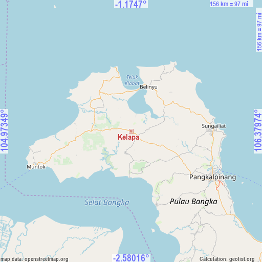
Kelapa GPS coordinates[2]
1° 52' 39.252" South, 105° 40' 35.796" East
| Map corner | latitude | longitude |
|---|---|---|
| Upper-left | -1.1747°, | 104.97349° |
| Center: | -1.87757°, | 105.67661° |
| Lower-right: | -2.58016°, | 106.37974° |
| Map W x H: | 156.3×156.3 km | = 97.1×97.1mi |
| max Lat: | 5.88969° ⇑7% North |
| Kelapa: | -1.87757° |
| min Lat: | ⇓93% South -10.934° |
| min Long | Kelapa | max Long |
| 95.1345° | 105.67661° | 140.9419° |
| W 5.9%⇐ | ⇒94.1% E |
Elevation
Elevation of Kelapa is 36 m = 118 ft, and this is 193.7 m = 635 ft below average elevation for this country.
| Max E: |
3185 m = 10449 ft | 68% |
| Avg. | 229.7 m = 754 ft | |
| Kelapa | 36 m = 118 ft | |
Min E: |
-1 m = -3 ft | 32% |
See also: Indonesia elevation on elevation.city.
Geographical zone
Kelapa is located in South Torrid zone (between Equator and Tropic of Capricorn). Distance of Equator is 208.8 km =129.7 mi to North.| Distance of | km | miles | from Kelapa |
|---|---|---|---|
| Equator | 208.8 | 129.7 | to North |
| Tropic Capricorn | 2397.2 | 1489.6 | to South |
| Antarctic Circle | 7192.4 | 4469.1 | to South |
| South Pole | 9798.3 | 6088.4 | to South |


Nearby cities:
15 places around Kelapa: (largest is in red/bold)
• Jebus
28.8 km =17.9 mi,  301°
301°
• Kepoh
153.8 km =95.6 mi,  140°
140°
• Koba
106.3 km =66.1 mi,  130°
130°
• Mislak
29.9 km =18.6 mi, 303°
• Muntok
60.9 km =37.8 mi,  249°
249°
• Nipah Panjang
187.4 km =116.4 mi, 298°
• Palembang
155.1 km =96.4 mi,  221°
221°
• Pangkalan Balai
181 km =112.5 mi,  231°
231°
• Pangkalpinang
56.1 km =34.9 mi,  119°
119°
• Simpang
188.3 km =117 mi,  291°
291°
• Sungaigerong
153.4 km =95.3 mi, 216°
• Sungailiat
49.6 km =30.8 mi,  87°
87°
• Sungsang
101.4 km =63 mi,  237°
237°
• Talangbetutu
156.2 km =97.1 mi, 224°
• Teritip
34.4 km =21.4 mi,  278°
278°
Sources, notices
• [Note1] Compared only with cities in Indonesia existing in our database
• [Src1] Map data: © OpenStreetMap contributors (CC-BY-SA)
• [Src2] Other city data from geonames.org with taken over terms of usage.
• [Src3] Geographical zone / Annual Mean Temperature by Robert A. Rohde @ Wikipedia
