Sungai Raya geodata
Sungai Raya (West Kalimantan) is a populated place; located in Indonesia in Asia/Pontianak (GMT+7) time zone. With population of 47,735 people, there are 243 cities with bigger population in this country. Compared to other cities in Indonesia, 95.7% of cities are located further ↓South; 67% of cities are located further →East and 92.1% of cities have higher elevation than Sungai Raya. Note1


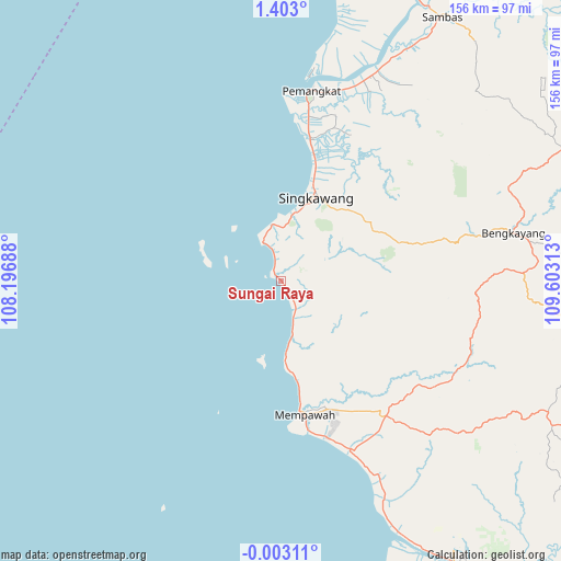
Sungai Raya GPS coordinates[2]
0° 42' 0" North, 108° 54' 0" East
| Map corner | latitude | longitude |
|---|---|---|
| Upper-left | 1.403°, | 108.19688° |
| Center: | 0.7°, | 108.9° |
| Lower-right: | -0.00311°, | 109.60313° |
| Map W x H: | 156.3×156.3 km | = 97.1×97.1mi |
| max Lat: | 5.88969° ⇑4.3% North |
| Sungai Raya: | 0.7° |
| min Lat: | ⇓95.7% South -10.934° |
| min Long | Sungai Raya | max Long |
| 95.1345° | 108.9° | 140.9419° |
| W 33%⇐ | ⇒67% E |
Elevation
Elevation of Sungai Raya is 9 m = 30 ft, and this is 220.7 m = 724 ft below average elevation for this country.
| Max E: |
3185 m = 10449 ft | 92.1% |
| Avg. | 229.7 m = 754 ft | |
| Sungai Raya | 9 m = 30 ft | |
Min E: |
-1 m = -3 ft | 7.9% |
See also: Sungai Raya elevation on elevation.city.
Geographical zone
Sungai Raya is located in North Torrid zone (between Equator and Tropic of Cancer). Distance of Equator is 77.8 km =48.3 mi to South.| Distance of | km | miles | from Sungai Raya |
|---|---|---|---|
| North Pole | 9929.2 | 6169.7 | to North |
| Arctic Circle | 7323.3 | 4550.5 | to North |
| Tropic Cancer | 2528.1 | 1570.9 | to North |
| Equator | 77.8 | 48.3 | to South |


Nearby cities:
15 places around Sungai Raya: (largest is in red/bold)
• Bengkayang
61.4 km =38.2 mi,  76°
76°
• Karangan
55.1 km =34.2 mi,  106°
106°
• Mandor
64.3 km =40 mi,  130°
130°
• Mempawah
37.4 km =23.2 mi,  167°
167°
• Menjalin
55.1 km =34.2 mi,  117°
117°
• Pemangkat
52.4 km =32.6 mi,  8°
8°
• Pontianak
94.1 km =58.5 mi,  149°
149°
• Pontianak Barat
92.5 km =57.5 mi, 149°
• Samalantan
34.6 km =21.5 mi,  72°
72°
• Sambas
80.5 km =50 mi,  28°
28°
• Singkawang
25.1 km =15.6 mi,  22°
22°
• Sungai Pinyuh
50.4 km =31.3 mi,  156°
156°
• Sungaiduri
15.2 km =9.4 mi, 167°
• Sungaikakap
90.3 km =56.1 mi, 157°
• Toho
47.4 km =29.5 mi, 131°
Sources, notices
• [Note1] Compared only with cities in Indonesia existing in our database
• [Src1] Map data: © OpenStreetMap contributors (CC-BY-SA)
• [Src2] Other city data from geonames.org with taken over terms of usage.
• [Src3] Geographical zone / Annual Mean Temperature by Robert A. Rohde @ Wikipedia
