Sambas geodata
Sambas (West Kalimantan) is a seat of a second-order administrative division; located in Indonesia in Asia/Pontianak (GMT+7) time zone. In our database, there are 407 cities with bigger population. Compared to other cities in Indonesia, 96.5% of cities are located further ↓South; 66.1% of cities are located further →East and 87.7% of cities have higher elevation than Sambas. Note1


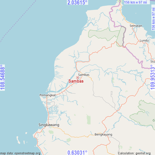
Sambas GPS coordinates[2]
1° 19' 59.988" North, 109° 15' 0" East
| Map corner | latitude | longitude |
|---|---|---|
| Upper-left | 2.03615°, | 108.54688° |
| Center: | 1.33333°, | 109.25° |
| Lower-right: | 0.63031°, | 109.95313° |
| Map W x H: | 156.3×156.3 km | = 97.1×97.1mi |
| max Lat: | 5.88969° ⇑3.5% North |
| Sambas: | 1.33333° |
| min Lat: | ⇓96.5% South -10.934° |
| min Long | Sambas | max Long |
| 95.1345° | 109.25° | 140.9419° |
| W 33.9%⇐ | ⇒66.1% E |
Elevation
Elevation of Sambas is 12 m = 39 ft, and this is 217.7 m = 714 ft below average elevation for this country.
| Max E: |
3185 m = 10449 ft | 87.7% |
| Avg. | 229.7 m = 754 ft | |
| Sambas | 12 m = 39 ft | |
Min E: |
-1 m = -3 ft | 12.3% |
See also: Indonesia elevation on elevation.city.
Geographical zone
Sambas is located in North Torrid zone (between Equator and Tropic of Cancer). Distance of Equator is 148.3 km =92.1 mi to South.| Distance of | km | miles | from Sambas |
|---|---|---|---|
| North Pole | 9858.8 | 6126 | to North |
| Arctic Circle | 7252.9 | 4506.7 | to North |
| Tropic Cancer | 2457.7 | 1527.1 | to North |
| Equator | 148.3 | 92.1 | to South |


Nearby cities:
15 places around Sambas: (largest is in red/bold)
• Bengkayang
59.5 km =37 mi,  159°
159°
• Karangan
87.1 km =54.1 mi,  170°
170°
• Mandor
112.8 km =70.1 mi,  175°
175°
• Mempawah
111.4 km =69.2 mi,  196°
196°
• Menjalin
96.6 km =60 mi, 174°
• Ngabang
131.2 km =81.5 mi,  143°
143°
• Pemangkat
36.5 km =22.7 mi,  239°
239°
• Pontianak Barat
150.6 km =93.6 mi, 177°
• Samalantan
60.4 km =37.5 mi,  185°
185°
• Serasan
133.2 km =82.8 mi,  349°
349°
• Singkawang
55.6 km =34.5 mi,  212°
212°
• Sungai Pinyuh
118.3 km =73.5 mi, 189°
• Sungai Raya
80.5 km =50 mi, 208°
• Sungaiduri
92.4 km =57.4 mi, 202°
• Toho
101.8 km =63.3 mi, 181°
Sources, notices
• [Note1] Compared only with cities in Indonesia existing in our database
• [Src1] Map data: © OpenStreetMap contributors (CC-BY-SA)
• [Src2] Other city data from geonames.org with taken over terms of usage.
• [Src3] Geographical zone / Annual Mean Temperature by Robert A. Rohde @ Wikipedia
