Pemangkat geodata
Pemangkat (West Kalimantan) is a populated place; located in Indonesia in Asia/Pontianak (GMT+7) time zone. With population of 34,029 people, there are 294 cities with bigger population in this country. Compared to other cities in Indonesia, 96.5% of cities are located further ↓South; 67% of cities are located further →East and 99.8% of cities have higher elevation than Pemangkat. Note1


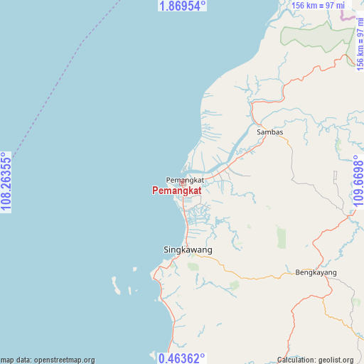
Pemangkat GPS coordinates[2]
1° 10' 0.012" North, 108° 58' 0.012" East
| Map corner | latitude | longitude |
|---|---|---|
| Upper-left | 1.86954°, | 108.26355° |
| Center: | 1.16667°, | 108.96667° |
| Lower-right: | 0.46362°, | 109.6698° |
| Map W x H: | 156.3×156.3 km | = 97.1×97.1mi |
| max Lat: | 5.88969° ⇑3.5% North |
| Pemangkat: | 1.16667° |
| min Lat: | ⇓96.5% South -10.934° |
| min Long | Pemangkat | max Long |
| 95.1345° | 108.96667° | 140.9419° |
| W 33%⇐ | ⇒67% E |
Elevation
Elevation of Pemangkat is 1 m = 3 ft, and this is 228.7 m = 750 ft below average elevation for this country.
| Max E: |
3185 m = 10449 ft | 99.8% |
| Avg. | 229.7 m = 754 ft | |
| Pemangkat | 1 m = 3 ft | |
Min E: |
-1 m = -3 ft | 0.2% |
See also: Indonesia elevation on elevation.city.
Geographical zone
Pemangkat is located in North Torrid zone (between Equator and Tropic of Cancer). Distance of Equator is 129.7 km =80.6 mi to South.| Distance of | km | miles | from Pemangkat |
|---|---|---|---|
| North Pole | 9877.3 | 6137.5 | to North |
| Arctic Circle | 7271.5 | 4518.3 | to North |
| Tropic Cancer | 2476.2 | 1538.6 | to North |
| Equator | 129.7 | 80.6 | to South |


Nearby cities:
15 places around Pemangkat: (largest is in red/bold)
• Bengkayang
64.1 km =39.8 mi,  125°
125°
• Karangan
81.4 km =50.6 mi,  146°
146°
• Mandor
102.5 km =63.7 mi,  156°
156°
• Mempawah
88.5 km =55 mi,  179°
179°
• Menjalin
87.9 km =54.6 mi, 151°
• Pontianak
139.1 km =86.4 mi, 163°
• Pontianak Barat
137.5 km =85.4 mi, 163°
• Samalantan
48.8 km =30.3 mi, 148°
• Sambas
36.5 km =22.7 mi,  59°
59°
• Singkawang
28.7 km =17.8 mi, 176°
• Sungai Pinyuh
99 km =61.5 mi,  172°
172°
• Sungai Raya
52.4 km =32.6 mi,  188°
188°
• Sungaiduri
66.9 km =41.6 mi, 183°
• Sungaikakap
138.1 km =85.8 mi, 168°
• Toho
87.9 km =54.6 mi, 161°
Sources, notices
• [Note1] Compared only with cities in Indonesia existing in our database
• [Src1] Map data: © OpenStreetMap contributors (CC-BY-SA)
• [Src2] Other city data from geonames.org with taken over terms of usage.
• [Src3] Geographical zone / Annual Mean Temperature by Robert A. Rohde @ Wikipedia
