Sungaibengkal geodata
Sungaibengkal (Jambi) is a seat of a fourth-order administrative division; located in Indonesia in Asia/Jakarta (GMT+7) time zone. In our database, there are 407 cities with bigger population. Compared to other cities in Indonesia, 93.4% of cities are located further ↓South; 95.9% of cities are located further →East and 69.5% of cities have higher elevation than Sungaibengkal. Note1


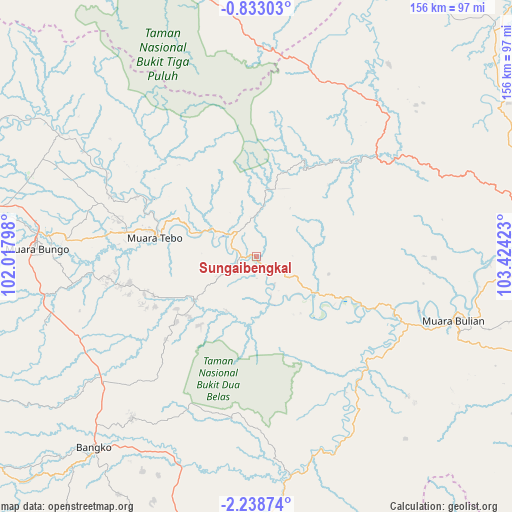
Sungaibengkal GPS coordinates[2]
1° 32' 9.6" South, 102° 43' 15.96" East
| Map corner | latitude | longitude |
|---|---|---|
| Upper-left | -0.83303°, | 102.01798° |
| Center: | -1.536°, | 102.7211° |
| Lower-right: | -2.23874°, | 103.42423° |
| Map W x H: | 156.3×156.3 km | = 97.1×97.1mi |
| max Lat: | 5.88969° ⇑6.6% North |
| Sungaibengkal: | -1.536° |
| min Lat: | ⇓93.4% South -10.934° |
| min Long | Sungaibengkal | max Long |
| 95.1345° | 102.7211° | 140.9419° |
| W 4.1%⇐ | ⇒95.9% E |
Elevation
Elevation of Sungaibengkal is 33 m = 108 ft, and this is 196.7 m = 645 ft below average elevation for this country.
| Max E: |
3185 m = 10449 ft | 69.5% |
| Avg. | 229.7 m = 754 ft | |
| Sungaibengkal | 33 m = 108 ft | |
Min E: |
-1 m = -3 ft | 30.5% |
See also: Indonesia elevation on elevation.city.
Geographical zone
Sungaibengkal is located in South Torrid zone (between Equator and Tropic of Capricorn). Distance of Equator is 170.8 km =106.1 mi to North.| Distance of | km | miles | from Sungaibengkal |
|---|---|---|---|
| Equator | 170.8 | 106.1 | to North |
| Tropic Capricorn | 2435.1 | 1513.1 | to South |
| Antarctic Circle | 7230.4 | 4492.8 | to South |
| South Pole | 9836.3 | 6112 | to South |


Nearby cities:
15 places around Sungaibengkal: (largest is in red/bold)
• Bangko
79.4 km =49.3 mi,  220°
220°
• Bejubang Dua
72.1 km =44.8 mi,  113°
113°
• Mersam
35.6 km =22.1 mi,  120°
120°
• Muara Bulian
63 km =39.1 mi, 108°
• Muara Bungo
67.6 km =42 mi,  274°
274°
• Muara Tebo
31.6 km =19.6 mi,  282°
282°
• Muara Tembesi
48.2 km =30 mi, 113°
• Pauh
67.9 km =42.2 mi,  170°
170°
• Pelabuhan Dagang
59.3 km =36.8 mi,  43°
43°
• Pulautemiang
63.5 km =39.5 mi,  303°
303°
• Rantauambacang
90.3 km =56.1 mi, 279°
• Rantaupanjang
57.3 km =35.6 mi,  233°
233°
• Sarolangun
86.3 km =53.6 mi,  179°
179°
• Sekernan
94.1 km =58.5 mi,  89°
89°
• Sengeti
87.7 km =54.5 mi, 85°
Sources, notices
• [Note1] Compared only with cities in Indonesia existing in our database
• [Src1] Map data: © OpenStreetMap contributors (CC-BY-SA)
• [Src2] Other city data from geonames.org with taken over terms of usage.
• [Src3] Geographical zone / Annual Mean Temperature by Robert A. Rohde @ Wikipedia
