Bejubang Dua geodata
Bejubang Dua (Jambi) is a populated place; located in Indonesia in Asia/Jakarta (GMT+7) time zone. With population of 7,957 people, there are 384 cities with bigger population in this country. Compared to other cities in Indonesia, 93.2% of cities are located further ↓South; 95.5% of cities are located further →East and 58.6% of cities have higher elevation than Bejubang Dua. Note1


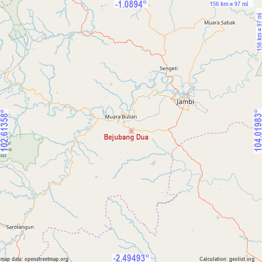
Bejubang Dua GPS coordinates[2]
1° 47' 32.28" South, 103° 19' 0.12" East
| Map corner | latitude | longitude |
|---|---|---|
| Upper-left | -1.0894°, | 102.61358° |
| Center: | -1.7923°, | 103.3167° |
| Lower-right: | -2.49493°, | 104.01983° |
| Map W x H: | 156.3×156.3 km | = 97.1×97.1mi |
| max Lat: | 5.88969° ⇑6.8% North |
| Bejubang Dua: | -1.7923° |
| min Lat: | ⇓93.2% South -10.934° |
| min Long | Bejubang Dua | max Long |
| 95.1345° | 103.3167° | 140.9419° |
| W 4.5%⇐ | ⇒95.5% E |
Elevation
Elevation of Bejubang Dua is 65 m = 213 ft, and this is 164.7 m = 540 ft below average elevation for this country.
| Max E: |
3185 m = 10449 ft | 58.6% |
| Avg. | 229.7 m = 754 ft | |
| Bejubang Dua | 65 m = 213 ft | |
Min E: |
-1 m = -3 ft | 41.4% |
See also: Indonesia elevation on elevation.city.
Geographical zone
Bejubang Dua is located in South Torrid zone (between Equator and Tropic of Capricorn). Distance of Equator is 199.3 km =123.8 mi to North.| Distance of | km | miles | from Bejubang Dua |
|---|---|---|---|
| Equator | 199.3 | 123.8 | to North |
| Tropic Capricorn | 2406.6 | 1495.4 | to South |
| Antarctic Circle | 7201.9 | 4475.1 | to South |
| South Pole | 9807.8 | 6094.3 | to South |


Nearby cities:
15 places around Bejubang Dua: (largest is in red/bold)
• Bayunglincir
50.1 km =31.1 mi,  125°
125°
• Bingintelok
95 km =59 mi,  193°
193°
• Jambi City
39.6 km =24.6 mi,  57°
57°
• Kenali Asam
36.6 km =22.7 mi,  67°
67°
• Mendaha
91.6 km =56.9 mi,  19°
19°
• Mersam
37 km =23 mi,  286°
286°
• Muara Bulian
10.9 km =6.8 mi,  323°
323°
• Muara Sabak
94 km =58.4 mi,  39°
39°
• Muara Tembesi
23.8 km =14.8 mi, 292°
• Pauh
67.4 km =41.9 mi,  235°
235°
• Pelabuhan Dagang
76.3 km =47.4 mi,  340°
340°
• Sarolangun
87.4 km =54.3 mi,  228°
228°
• Sekernan
40.9 km =25.4 mi, 42°
• Sengeti
41 km =25.5 mi,  31°
31°
• Sungaibengkal
72.1 km =44.8 mi, 293°
Sources, notices
• [Note1] Compared only with cities in Indonesia existing in our database
• [Src1] Map data: © OpenStreetMap contributors (CC-BY-SA)
• [Src2] Other city data from geonames.org with taken over terms of usage.
• [Src3] Geographical zone / Annual Mean Temperature by Robert A. Rohde @ Wikipedia
