Pundong geodata
Pundong (Yogyakarta) is a populated place; located in Indonesia in Asia/Jakarta (GMT+7) time zone. With population of 24,081 people, there are 357 cities with bigger population in this country. Compared to other cities in Indonesia, 61.2% of cities are located further ↑North; 65.5% of cities are located further →East and 74.1% of cities have higher elevation than Pundong. Note1


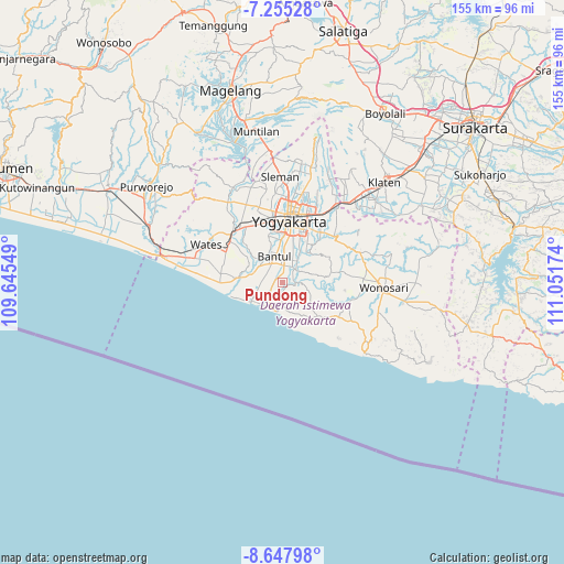
Pundong GPS coordinates[2]
7° 57' 7.992" South, 110° 20' 54.996" East
| Map corner | latitude | longitude |
|---|---|---|
| Upper-left | -7.25528°, | 109.64549° |
| Center: | -7.95222°, | 110.34861° |
| Lower-right: | -8.64798°, | 111.05174° |
| Map W x H: | 154.9×154.9 km | = 96.3×96.3mi |
| max Lat: | 5.88969° ⇑61.2% North |
| Pundong: | -7.95222° |
| min Lat: | ⇓38.8% South -10.934° |
| min Long | Pundong | max Long |
| 95.1345° | 110.34861° | 140.9419° |
| W 34.5%⇐ | ⇒65.5% E |
Elevation
Elevation of Pundong is 26 m = 85 ft, and this is 203.7 m = 668 ft below average elevation for this country.
| Max E: |
3185 m = 10449 ft | 74.1% |
| Avg. | 229.7 m = 754 ft | |
| Pundong | 26 m = 85 ft | |
Min E: |
-1 m = -3 ft | 25.9% |
See also: Indonesia elevation on elevation.city.
Geographical zone
Pundong is located in South Torrid zone (between Equator and Tropic of Capricorn). Distance of Equator is 884.2 km =549.4 mi to North.| Distance of | km | miles | from Pundong |
|---|---|---|---|
| Equator | 884.2 | 549.4 | to North |
| Tropic Capricorn | 1721.7 | 1069.8 | to South |
| Antarctic Circle | 6517 | 4049.5 | to South |
| South Pole | 9122.9 | 5668.7 | to South |


Nearby cities:
15 places around Pundong: (largest is in red/bold)
• Bambanglipuro
7.2 km =4.5 mi,  271°
271°
• Bantul
7.5 km =4.7 mi,  343°
343°
• Candi Prambanan
27.6 km =17.1 mi,  35°
35°
• Depok
23 km =14.3 mi,  23°
23°
• Gamping Lor
17.6 km =10.9 mi,  352°
352°
• Godean
21.2 km =13.2 mi, 343°
• Kasihan
14.1 km =8.8 mi, 351°
• Melati
24.4 km =15.2 mi,  4°
4°
• Pandak
7.5 km =4.7 mi,  305°
305°
• Pugeran Maguwoharjo
22.1 km =13.7 mi, 21°
• Sewon
8.5 km =5.3 mi,  7°
7°
• Sleman
26.3 km =16.3 mi, 1°
• Srandakan
10.9 km =6.8 mi,  277°
277°
• Wates
23.6 km =14.7 mi,  296°
296°
• Yogyakarta
16.9 km =10.5 mi, 6°
Sources, notices
• [Note1] Compared only with cities in Indonesia existing in our database
• [Src1] Map data: © OpenStreetMap contributors (CC-BY-SA)
• [Src2] Other city data from geonames.org with taken over terms of usage.
• [Src3] Geographical zone / Annual Mean Temperature by Robert A. Rohde @ Wikipedia
