Pangkajene geodata
Pangkajene (South Sulawesi) is a seat of a second-order administrative division; located in Indonesia in Asia/Makassar (GMT+8) time zone. In our database, there are 407 cities with bigger population. Compared to other cities in Indonesia, 88.8% of cities are located further ↓South; 81.9% of cities are located further ←West and 95.5% of cities have higher elevation than Pangkajene. Note1


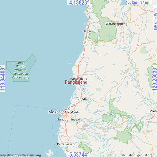
Pangkajene GPS coordinates[2]
4° 50' 13.92" South, 119° 32' 49.92" East
| Map corner | latitude | longitude |
|---|---|---|
| Upper-left | -4.13623°, | 118.84408° |
| Center: | -4.8372°, | 119.5472° |
| Lower-right: | -5.53744°, | 120.25033° |
| Map W x H: | 155.8×155.8 km | = 96.8×96.8mi |
| max Lat: | 5.88969° ⇑11.2% North |
| Pangkajene: | -4.8372° |
| min Lat: | ⇓88.8% South -10.934° |
| min Long | Pangkajene | max Long |
| 95.1345° | 119.5472° | 140.9419° |
| W 81.9%⇐ | ⇒18.1% E |
Elevation
Elevation of Pangkajene is 7 m = 23 ft, and this is 222.7 m = 731 ft below average elevation for this country.
| Max E: |
3185 m = 10449 ft | 95.5% |
| Avg. | 229.7 m = 754 ft | |
| Pangkajene | 7 m = 23 ft | |
Min E: |
-1 m = -3 ft | 4.5% |
See also: Indonesia elevation on elevation.city.
Geographical zone
Pangkajene is located in South Torrid zone (between Equator and Tropic of Capricorn). Distance of Equator is 537.8 km =334.2 mi to North.| Distance of | km | miles | from Pangkajene |
|---|---|---|---|
| Equator | 537.8 | 334.2 | to North |
| Tropic Capricorn | 2068.1 | 1285.1 | to South |
| Antarctic Circle | 6863.3 | 4264.7 | to South |
| South Pole | 9469.2 | 5883.9 | to South |


Nearby cities:
15 places around Pangkajene: (largest is in red/bold)
• Barru
47.9 km =29.8 mi,  9°
9°
• Bulubulu
81.8 km =50.8 mi,  95°
95°
• Camming
58.8 km =36.5 mi,  87°
87°
• Galesong
57 km =35.4 mi,  200°
200°
• Kadai
88.2 km =54.8 mi, 87°
• Kotabaru
86.2 km =53.6 mi,  36°
36°
• Makassar
36.9 km =22.9 mi, 200°
• Maros
19 km =11.8 mi,  171°
171°
• Matango
55.3 km =34.4 mi,  69°
69°
• Palattae
64.4 km =40 mi, 103°
• Sinjai
84.4 km =52.4 mi,  112°
112°
• Sungguminasa
41.4 km =25.7 mi,  194°
194°
• Taccipi
79.6 km =49.5 mi,  62°
62°
• Takalar
66.5 km =41.3 mi, 190°
• Watansoppeng
65.6 km =40.8 mi,  34°
34°
Sources, notices
• [Note1] Compared only with cities in Indonesia existing in our database
• [Src1] Map data: © OpenStreetMap contributors (CC-BY-SA)
• [Src2] Other city data from geonames.org with taken over terms of usage.
• [Src3] Geographical zone / Annual Mean Temperature by Robert A. Rohde @ Wikipedia
