Pamekasan geodata
Pamekasan (East Java) is a seat of a second-order administrative division; located in Indonesia in Asia/Jakarta (GMT+7) time zone. With population of 92,447 people, there are 141 cities with bigger population in this country. Compared to other cities in Indonesia, 57.3% of cities are located further ↓South; 61.8% of cities are located further ←West and 80.9% of cities have higher elevation than Pamekasan. Note1


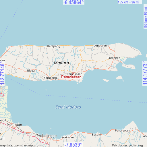
Pamekasan GPS coordinates[2]
7° 9' 24.48" South, 113° 28' 28.56" East
| Map corner | latitude | longitude |
|---|---|---|
| Upper-left | -6.45864°, | 112.77148° |
| Center: | -7.1568°, | 113.4746° |
| Lower-right: | -7.8539°, | 114.17773° |
| Map W x H: | 155.1×155.1 km | = 96.4×96.4mi |
| max Lat: | 5.88969° ⇑42.7% North |
| Pamekasan: | -7.1568° |
| min Lat: | ⇓57.3% South -10.934° |
| min Long | Pamekasan | max Long |
| 95.1345° | 113.4746° | 140.9419° |
| W 61.8%⇐ | ⇒38.2% E |
Elevation
Elevation of Pamekasan is 18 m = 59 ft, and this is 211.7 m = 695 ft below average elevation for this country.
| Max E: |
3185 m = 10449 ft | 80.9% |
| Avg. | 229.7 m = 754 ft | |
| Pamekasan | 18 m = 59 ft | |
Min E: |
-1 m = -3 ft | 19.1% |
See also: Pamekasan elevation on elevation.city.
Geographical zone
Pamekasan is located in South Torrid zone (between Equator and Tropic of Capricorn). Distance of Equator is 795.8 km =494.5 mi to North.| Distance of | km | miles | from Pamekasan |
|---|---|---|---|
| Equator | 795.8 | 494.5 | to North |
| Tropic Capricorn | 1810.2 | 1124.8 | to South |
| Antarctic Circle | 6605.4 | 4104.4 | to South |
| South Pole | 9211.3 | 5723.6 | to South |


Nearby cities:
15 places around Pamekasan: (largest is in red/bold)
• Biris Daja
5 km =3.1 mi,  86°
86°
• Bulung
3.9 km =2.4 mi, 92°
• Dorbuk Utara
5.2 km =3.2 mi,  141°
141°
• Karangdalam
5.5 km =3.4 mi,  130°
130°
• Kebon
4.4 km =2.7 mi, 135°
• Lobuk
4.9 km =3 mi, 92°
• Morsoksok
6.2 km =3.9 mi,  155°
155°
• Murtajih
4 km =2.5 mi,  106°
106°
• Ombul
2.6 km =1.6 mi,  75°
75°
• Pademawu
6.5 km =4 mi,  120°
120°
• Rongrongan
6 km =3.7 mi, 83°
• Temorlorong
5.6 km =3.5 mi,  62°
62°
• Trasak
6 km =3.7 mi, 63°
• Utara
3 km =1.9 mi, 115°
• Utara
5.3 km =3.3 mi,  152°
152°
Sources, notices
• [Note1] Compared only with cities in Indonesia existing in our database
• [Src1] Map data: © OpenStreetMap contributors (CC-BY-SA)
• [Src2] Other city data from geonames.org with taken over terms of usage.
• [Src3] Geographical zone / Annual Mean Temperature by Robert A. Rohde @ Wikipedia
