Murtajih geodata
Murtajih (East Java) is a seat of a fourth-order administrative division; located in Indonesia in Asia/Jakarta (GMT+7) time zone. In our database, there are 407 cities with bigger population. Compared to other cities in Indonesia, 56.6% of cities are located further ↓South; 62.3% of cities are located further ←West and 74.9% of cities have higher elevation than Murtajih. Note1


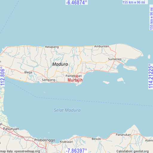
Murtajih GPS coordinates[2]
7° 10' 0.804" South, 113° 30' 32.832" East
| Map corner | latitude | longitude |
|---|---|---|
| Upper-left | -6.46874°, | 112.806° |
| Center: | -7.16689°, | 113.50912° |
| Lower-right: | -7.86397°, | 114.21225° |
| Map W x H: | 155.1×155.1 km | = 96.4×96.4mi |
| max Lat: | 5.88969° ⇑43.4% North |
| Murtajih: | -7.16689° |
| min Lat: | ⇓56.6% South -10.934° |
| min Long | Murtajih | max Long |
| 95.1345° | 113.50912° | 140.9419° |
| W 62.3%⇐ | ⇒37.7% E |
Elevation
Elevation of Murtajih is 25 m = 82 ft, and this is 204.7 m = 672 ft below average elevation for this country.
| Max E: |
3185 m = 10449 ft | 74.9% |
| Avg. | 229.7 m = 754 ft | |
| Murtajih | 25 m = 82 ft | |
Min E: |
-1 m = -3 ft | 25.1% |
See also: Indonesia elevation on elevation.city.
Geographical zone
Murtajih is located in South Torrid zone (between Equator and Tropic of Capricorn). Distance of Equator is 796.9 km =495.2 mi to North.| Distance of | km | miles | from Murtajih |
|---|---|---|---|
| Equator | 796.9 | 495.2 | to North |
| Tropic Capricorn | 1809 | 1124.1 | to South |
| Antarctic Circle | 6604.3 | 4103.7 | to South |
| South Pole | 9210.2 | 5723 | to South |


Nearby cities:
15 places around Murtajih: (largest is in red/bold)
• Biris Daja
1.9 km =1.2 mi,  38°
38°
• Bulung
1 km =0.6 mi,  6°
6°
• Bunder
3.2 km =2 mi,  134°
134°
• Dorbuk Utara
3 km =1.9 mi,  191°
191°
• Karangdalam
2.5 km =1.6 mi,  171°
171°
• Kebon
2.1 km =1.3 mi,  200°
200°
• Lobuk
1.4 km =0.9 mi,  50°
50°
• Ombul
2.2 km =1.4 mi,  324°
324°
• Pademawu
2.8 km =1.7 mi,  139°
139°
• Pamekasan
4 km =2.5 mi,  286°
286°
• Rongrongan
2.8 km =1.7 mi, 49°
• Tandes
3.6 km =2.2 mi,  73°
73°
• Temorlorong
3.9 km =2.4 mi,  18°
18°
• Utara
1.2 km =0.7 mi,  262°
262°
• Utara
3.8 km =2.4 mi, 201°
Sources, notices
• [Note1] Compared only with cities in Indonesia existing in our database
• [Src1] Map data: © OpenStreetMap contributors (CC-BY-SA)
• [Src2] Other city data from geonames.org with taken over terms of usage.
• [Src3] Geographical zone / Annual Mean Temperature by Robert A. Rohde @ Wikipedia
