Loa Janan geodata
Loa Janan (East Kalimantan) is a populated place; located in Indonesia in Asia/Makassar (GMT+8) time zone. With population of 212,816 people, there are 46 cities with bigger population in this country. Compared to other cities in Indonesia, 94.4% of cities are located further ↓South; 78.5% of cities are located further ←West and 92.1% of cities have higher elevation than Loa Janan. Note1


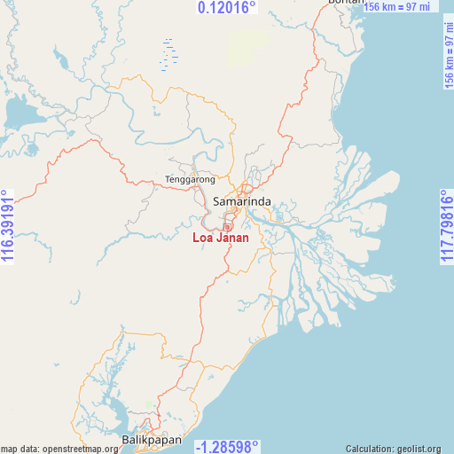
Loa Janan GPS coordinates[2]
0° 34' 58.62" South, 117° 5' 42.108" East
| Map corner | latitude | longitude |
|---|---|---|
| Upper-left | 0.12016°, | 116.39191° |
| Center: | -0.58295°, | 117.09503° |
| Lower-right: | -1.28598°, | 117.79816° |
| Map W x H: | 156.3×156.4 km | = 97.1×97.2mi |
| max Lat: | 5.88969° ⇑5.6% North |
| Loa Janan: | -0.58295° |
| min Lat: | ⇓94.4% South -10.934° |
| min Long | Loa Janan | max Long |
| 95.1345° | 117.09503° | 140.9419° |
| W 78.5%⇐ | ⇒21.5% E |
Elevation
Elevation of Loa Janan is 9 m = 30 ft, and this is 220.7 m = 724 ft below average elevation for this country.
| Max E: |
3185 m = 10449 ft | 92.1% |
| Avg. | 229.7 m = 754 ft | |
| Loa Janan | 9 m = 30 ft | |
Min E: |
-1 m = -3 ft | 7.9% |
See also: Loa Janan elevation on elevation.city.
Geographical zone
Loa Janan is located in South Torrid zone (between Equator and Tropic of Capricorn). Distance of Equator is 64.8 km =40.3 mi to North.| Distance of | km | miles | from Loa Janan |
|---|---|---|---|
| Equator | 64.8 | 40.3 | to North |
| Tropic Capricorn | 2541.1 | 1579 | to South |
| Antarctic Circle | 7336.4 | 4558.6 | to South |
| South Pole | 9942.2 | 6177.8 | to South |


Nearby cities:
15 places around Loa Janan: (largest is in red/bold)
• Anggana
21.1 km =13.1 mi,  86°
86°
• Balikpapan
81.7 km =50.8 mi,  201°
201°
• Bontang
90.6 km =56.3 mi,  28°
28°
• Bontang Baru
89.4 km =55.6 mi, 29°
• City of Balikpapan
76.6 km =47.6 mi, 196°
• Handilenam
31.8 km =19.8 mi,  147°
147°
• Loakulu
11.6 km =7.2 mi,  310°
310°
• Muarabadak
45.8 km =28.5 mi,  55°
55°
• Palaran
11.3 km =7 mi,  83°
83°
• Penajam
82.4 km =51.2 mi,  206°
206°
• Samarinda
11.6 km =7.2 mi, 29°
• Samboja
50.5 km =31.4 mi,  187°
187°
• Sangasangadalam
18 km =11.2 mi,  119°
119°
• Sangatta
130.2 km =80.9 mi,  21°
21°
• Sebulu
36 km =22.4 mi,  342°
342°
Sources, notices
• [Note1] Compared only with cities in Indonesia existing in our database
• [Src1] Map data: © OpenStreetMap contributors (CC-BY-SA)
• [Src2] Other city data from geonames.org with taken over terms of usage.
• [Src3] Geographical zone / Annual Mean Temperature by Robert A. Rohde @ Wikipedia
