Labuhankananga geodata
Labuhankananga (West Nusa Tenggara) is a seat of a fourth-order administrative division; located in Indonesia in Asia/Makassar (GMT+8) time zone. In our database, there are 407 cities with bigger population. Compared to other cities in Indonesia, 67.8% of cities are located further ↑North; 79.3% of cities are located further ←West and 87.7% of cities have higher elevation than Labuhankananga. Note1


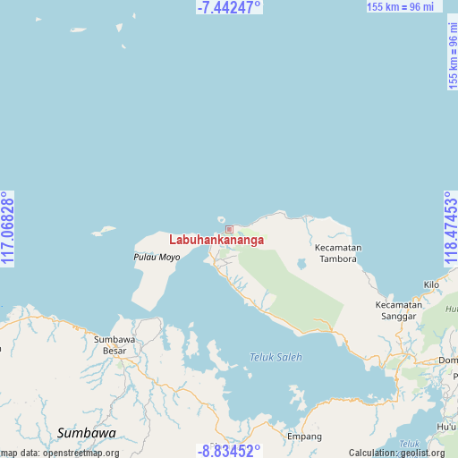
Labuhankananga GPS coordinates[2]
8° 8' 20.76" South, 117° 46' 17.04" East
| Map corner | latitude | longitude |
|---|---|---|
| Upper-left | -7.44247°, | 117.06828° |
| Center: | -8.1391°, | 117.7714° |
| Lower-right: | -8.83452°, | 118.47453° |
| Map W x H: | 154.8×154.8 km | = 96.2×96.2mi |
| max Lat: | 5.88969° ⇑67.8% North |
| Labuhankananga: | -8.1391° |
| min Lat: | ⇓32.2% South -10.934° |
| min Long | Labuhankananga | max Long |
| 95.1345° | 117.7714° | 140.9419° |
| W 79.3%⇐ | ⇒20.7% E |
Elevation
Elevation of Labuhankananga is 12 m = 39 ft, and this is 217.7 m = 714 ft below average elevation for this country.
| Max E: |
3185 m = 10449 ft | 87.7% |
| Avg. | 229.7 m = 754 ft | |
| Labuhankananga | 12 m = 39 ft | |
Min E: |
-1 m = -3 ft | 12.3% |
See also: Indonesia elevation on elevation.city.
Geographical zone
Labuhankananga is located in South Torrid zone (between Equator and Tropic of Capricorn). Distance of Equator is 905 km =562.3 mi to North.| Distance of | km | miles | from Labuhankananga |
|---|---|---|---|
| Equator | 905 | 562.3 | to North |
| Tropic Capricorn | 1700.9 | 1056.9 | to South |
| Antarctic Circle | 6496.2 | 4036.6 | to South |
| South Pole | 9102.1 | 5655.8 | to South |


Nearby cities:
15 places around Labuhankananga: (largest is in red/bold)
• Doropeti
23.7 km =14.7 mi,  166°
166°
• Karangbalong
54.5 km =33.9 mi,  224°
224°
• Karangmete
15.4 km =9.6 mi,  188°
188°
• Kembansari
55.1 km =34.2 mi,  226°
226°
• Labuhanaji
32.6 km =20.3 mi,  254°
254°
• Labuhankuris
51.4 km =31.9 mi,  197°
197°
• Labuhansumbawa
55.1 km =34.2 mi, 227°
• Ngeru
50.6 km =31.4 mi,  213°
213°
• Osapsio
54.6 km =33.9 mi, 226°
• Penyaring Bawah
49.8 km =30.9 mi, 222°
• Poto
51.4 km =31.9 mi, 218°
• Pototano
44.1 km =27.4 mi, 226°
• Sebewe
49.6 km =30.8 mi, 220°
• Songkar B
48.9 km =30.4 mi, 218°
• Sorinomo
14 km =8.7 mi, 168°
Sources, notices
• [Note1] Compared only with cities in Indonesia existing in our database
• [Src1] Map data: © OpenStreetMap contributors (CC-BY-SA)
• [Src2] Other city data from geonames.org with taken over terms of usage.
• [Src3] Geographical zone / Annual Mean Temperature by Robert A. Rohde @ Wikipedia
