Gebog geodata
Gebog (Central Java) is a populated place; located in Indonesia in Asia/Jakarta (GMT+7) time zone. With population of 43,756 people, there are 257 cities with bigger population in this country. Compared to other cities in Indonesia, 78.9% of cities are located further ↓South; 65.1% of cities are located further →East and 55.4% of cities have lower elevation than Gebog. Note1


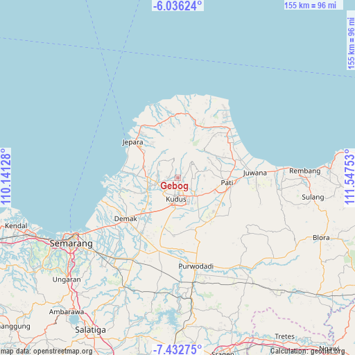
Gebog GPS coordinates[2]
6° 44' 6" South, 110° 50' 39.84" East
| Map corner | latitude | longitude |
|---|---|---|
| Upper-left | -6.03624°, | 110.14128° |
| Center: | -6.735°, | 110.8444° |
| Lower-right: | -7.43275°, | 111.54753° |
| Map W x H: | 155.3×155.3 km | = 96.5×96.5mi |
| max Lat: | 5.88969° ⇑21.1% North |
| Gebog: | -6.735° |
| min Lat: | ⇓78.9% South -10.934° |
| min Long | Gebog | max Long |
| 95.1345° | 110.8444° | 140.9419° |
| W 34.9%⇐ | ⇒65.1% E |
Elevation
Elevation of Gebog is 127 m = 417 ft, and this is 102.7 m = 337 ft below average elevation for this country.
| Max E: |
3185 m = 10449 ft | 44.6% |
| Avg. | 229.7 m = 754 ft | |
| Gebog | 127 m = 417 ft | |
Min E: |
-1 m = -3 ft | 55.4% |
See also: Gebog elevation on elevation.city.
Geographical zone
Gebog is located in South Torrid zone (between Equator and Tropic of Capricorn). Distance of Equator is 748.9 km =465.3 mi to North.| Distance of | km | miles | from Gebog |
|---|---|---|---|
| Equator | 748.9 | 465.3 | to North |
| Tropic Capricorn | 1857.1 | 1153.9 | to South |
| Antarctic Circle | 6652.3 | 4133.5 | to South |
| South Pole | 9258.2 | 5752.8 | to South |


Nearby cities:
15 places around Gebog: (largest is in red/bold)
• Baekrajan
3.8 km =2.4 mi,  163°
163°
• Gemiring
19 km =11.8 mi,  96°
96°
• Jekulo
12 km =7.5 mi,  131°
131°
• Karangnongko
19.5 km =12.1 mi,  84°
84°
• Kudus
7.8 km =4.8 mi,  183°
183°
• Lahar
19.3 km =12 mi,  58°
58°
• Pecangaan
15.3 km =9.5 mi,  285°
285°
• Puri
20 km =12.4 mi,  94°
94°
• Purwosari
17.8 km =11.1 mi, 77°
• Randangan
16.3 km =10.1 mi, 79°
• Rendole
18.5 km =11.5 mi, 89°
• Sanglur
19.2 km =11.9 mi,  65°
65°
• Tlogorejo
19.2 km =11.9 mi, 81°
• Tlogowungu
19 km =11.8 mi, 80°
• Welahan
15.8 km =9.8 mi,  242°
242°
Sources, notices
• [Note1] Compared only with cities in Indonesia existing in our database
• [Src1] Map data: © OpenStreetMap contributors (CC-BY-SA)
• [Src2] Other city data from geonames.org with taken over terms of usage.
• [Src3] Geographical zone / Annual Mean Temperature by Robert A. Rohde @ Wikipedia
