Cempaka geodata
Cempaka (South Sumatra) is a seat of a third-order administrative division; located in Indonesia in Asia/Jakarta (GMT+7) time zone. In our database, there are 407 cities with bigger population. Compared to other cities in Indonesia, 89.9% of cities are located further ↓South; 94.8% of cities are located further →East and 70.2% of cities have higher elevation than Cempaka. Note1


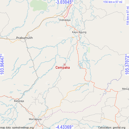
Cempaka GPS coordinates[2]
3° 43' 56.46" South, 104° 40' 3.324" East
| Map corner | latitude | longitude |
|---|---|---|
| Upper-left | -3.03045°, | 103.96447° |
| Center: | -3.73235°, | 104.66759° |
| Lower-right: | -4.43369°, | 105.37072° |
| Map W x H: | 156×156 km | = 96.9×96.9mi |
| max Lat: | 5.88969° ⇑10.1% North |
| Cempaka: | -3.73235° |
| min Lat: | ⇓89.9% South -10.934° |
| min Long | Cempaka | max Long |
| 95.1345° | 104.66759° | 140.9419° |
| W 5.2%⇐ | ⇒94.8% E |
Elevation
Elevation of Cempaka is 32 m = 105 ft, and this is 197.7 m = 649 ft below average elevation for this country.
| Max E: |
3185 m = 10449 ft | 70.2% |
| Avg. | 229.7 m = 754 ft | |
| Cempaka | 32 m = 105 ft | |
Min E: |
-1 m = -3 ft | 29.8% |
See also: Indonesia elevation on elevation.city.
Geographical zone
Cempaka is located in South Torrid zone (between Equator and Tropic of Capricorn). Distance of Equator is 415 km =257.9 mi to North.| Distance of | km | miles | from Cempaka |
|---|---|---|---|
| Equator | 415 | 257.9 | to North |
| Tropic Capricorn | 2190.9 | 1361.4 | to South |
| Antarctic Circle | 6986.2 | 4341 | to South |
| South Pole | 9592.1 | 5960.3 | to South |


Nearby cities:
15 places around Cempaka: (largest is in red/bold)
• Baturaja
70.9 km =44.1 mi,  231°
231°
• Glumbang
60.5 km =37.6 mi,  334°
334°
• Indralaya
53.4 km =33.2 mi,  0°
0°
• Kayu Agung
41.9 km =26 mi,  25°
25°
• Kurungannyawa
60.6 km =37.7 mi,  201°
201°
• Martapura
74.3 km =46.2 mi,  208°
208°
• Muarakuang
13.3 km =8.3 mi,  303°
303°
• Pedamaran
33 km =20.5 mi, 34°
• Peninjawan
35.1 km =21.8 mi,  244°
244°
• Prabumulih
58.7 km =36.5 mi, 304°
• Suban Jeriji
78.1 km =48.5 mi,  268°
268°
• Sungairotan
82.3 km =51.1 mi, 328°
• Tanjung Lubuk
25 km =15.5 mi,  23°
23°
• Tanjung Lubuk
45.8 km =28.5 mi, 25°
• Tanjungraja
45.5 km =28.3 mi, 15°
Sources, notices
• [Note1] Compared only with cities in Indonesia existing in our database
• [Src1] Map data: © OpenStreetMap contributors (CC-BY-SA)
• [Src2] Other city data from geonames.org with taken over terms of usage.
• [Src3] Geographical zone / Annual Mean Temperature by Robert A. Rohde @ Wikipedia
