Suban Jeriji geodata
Suban Jeriji (South Sumatra) is a seat of a third-order administrative division; located in Indonesia in Asia/Jakarta (GMT+7) time zone. In our database, there are 407 cities with bigger population. Compared to other cities in Indonesia, 89.9% of cities are located further ↓South; 95.1% of cities are located further →East and 54.6% of cities have higher elevation than Suban Jeriji. Note1


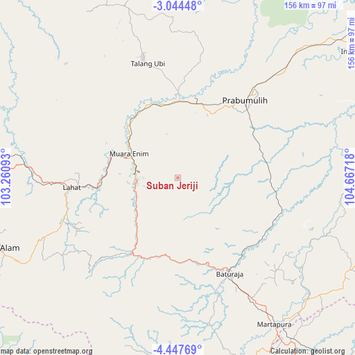
Suban Jeriji GPS coordinates[2]
3° 44' 46.932" South, 103° 57' 50.58" East
| Map corner | latitude | longitude |
|---|---|---|
| Upper-left | -3.04448°, | 103.26093° |
| Center: | -3.74637°, | 103.96405° |
| Lower-right: | -4.44769°, | 104.66718° |
| Map W x H: | 156×156 km | = 96.9×96.9mi |
| max Lat: | 5.88969° ⇑10.1% North |
| Suban Jeriji: | -3.74637° |
| min Lat: | ⇓89.9% South -10.934° |
| min Long | Suban Jeriji | max Long |
| 95.1345° | 103.96405° | 140.9419° |
| W 4.9%⇐ | ⇒95.1% E |
Elevation
Elevation of Suban Jeriji is 87 m = 285 ft, and this is 142.7 m = 468 ft below average elevation for this country.
| Max E: |
3185 m = 10449 ft | 54.6% |
| Avg. | 229.7 m = 754 ft | |
| Suban Jeriji | 87 m = 285 ft | |
Min E: |
-1 m = -3 ft | 45.4% |
See also: Indonesia elevation on elevation.city.
Geographical zone
Suban Jeriji is located in South Torrid zone (between Equator and Tropic of Capricorn). Distance of Equator is 416.6 km =258.9 mi to North.| Distance of | km | miles | from Suban Jeriji |
|---|---|---|---|
| Equator | 416.6 | 258.9 | to North |
| Tropic Capricorn | 2189.4 | 1360.4 | to South |
| Antarctic Circle | 6984.6 | 4340 | to South |
| South Pole | 9590.5 | 5959.3 | to South |


Nearby cities:
15 places around Suban Jeriji: (largest is in red/bold)
• Baturaja
48.1 km =29.9 mi,  152°
152°
• Bunga Mas
66.3 km =41.2 mi,  274°
274°
• Gunungmegang Dalam
34.6 km =21.5 mi,  342°
342°
• Gunungmenang
63.5 km =39.5 mi,  6°
6°
• Lahat
46.9 km =29.1 mi,  264°
264°
• Muara Enim
24 km =14.9 mi,  296°
296°
• Muaradua
56.8 km =35.3 mi,  223°
223°
• Muarakuang
67.5 km =41.9 mi,  82°
82°
• Negeriagung
34.7 km =21.6 mi, 266°
• Pengandonan
35.6 km =22.1 mi,  195°
195°
• Peninjawan
48.4 km =30.1 mi,  106°
106°
• Prabumulih
45.6 km =28.3 mi,  40°
40°
• Pulaupinang
51.8 km =32.2 mi,  251°
251°
• Talang Ubi
55.6 km =34.5 mi, 343°
• Tanjungagung
27.6 km =17.1 mi, 219°
Sources, notices
• [Note1] Compared only with cities in Indonesia existing in our database
• [Src1] Map data: © OpenStreetMap contributors (CC-BY-SA)
• [Src2] Other city data from geonames.org with taken over terms of usage.
• [Src3] Geographical zone / Annual Mean Temperature by Robert A. Rohde @ Wikipedia
