Biha geodata
Biha (Lampung) is a seat of a third-order administrative division; located in Indonesia in Asia/Jakarta (GMT+7) time zone. In our database, there are 407 cities with bigger population. Compared to other cities in Indonesia, 88.4% of cities are located further ↓South; 95.1% of cities are located further →East and 93.7% of cities have higher elevation than Biha. Note1


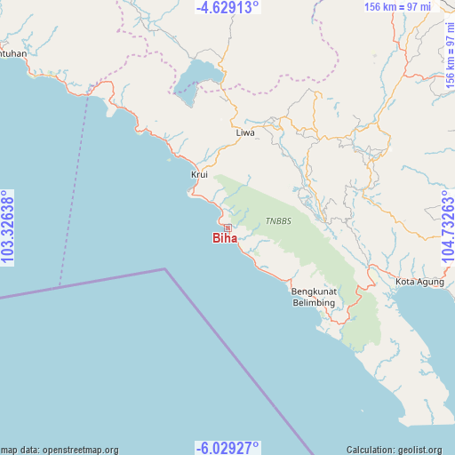
Biha GPS coordinates[2]
5° 19' 46.56" South, 104° 1' 46.2" East
| Map corner | latitude | longitude |
|---|---|---|
| Upper-left | -4.62913°, | 103.32638° |
| Center: | -5.3296°, | 104.0295° |
| Lower-right: | -6.02927°, | 104.73263° |
| Map W x H: | 155.7×155.7 km | = 96.7×96.7mi |
| max Lat: | 5.88969° ⇑11.6% North |
| Biha: | -5.3296° |
| min Lat: | ⇓88.4% South -10.934° |
| min Long | Biha | max Long |
| 95.1345° | 104.0295° | 140.9419° |
| W 4.9%⇐ | ⇒95.1% E |
Elevation
Elevation of Biha is 8 m = 26 ft, and this is 221.7 m = 727 ft below average elevation for this country.
| Max E: |
3185 m = 10449 ft | 93.7% |
| Avg. | 229.7 m = 754 ft | |
| Biha | 8 m = 26 ft | |
Min E: |
-1 m = -3 ft | 6.3% |
See also: Indonesia elevation on elevation.city.
Geographical zone
Biha is located in South Torrid zone (between Equator and Tropic of Capricorn). Distance of Equator is 592.6 km =368.2 mi to North.| Distance of | km | miles | from Biha |
|---|---|---|---|
| Equator | 592.6 | 368.2 | to North |
| Tropic Capricorn | 2013.3 | 1251 | to South |
| Antarctic Circle | 6808.6 | 4230.7 | to South |
| South Pole | 9414.5 | 5849.9 | to South |


Nearby cities:
15 places around Biha: (largest is in red/bold)
• Banding Agung
59 km =36.7 mi,  348°
348°
• Bara Datu
83.1 km =51.6 mi,  38°
38°
• Bukitkemuning
79.8 km =49.6 mi,  49°
49°
• Kasui
82.6 km =51.3 mi,  34°
34°
• Kenali
41.7 km =25.9 mi, 25°
• Kota Agung
70.8 km =44 mi,  105°
105°
• Kotaagung
68.1 km =42.3 mi, 105°
• Krui
19.3 km =12 mi,  328°
328°
• Kuripan
44 km =27.3 mi,  318°
318°
• Liwa
33.1 km =20.6 mi,  8°
8°
• Muara Dua
88.8 km =55.2 mi,  3°
3°
• Oganlima
90.6 km =56.3 mi,  55°
55°
• Pasar Banjit
77.5 km =48.2 mi, 40°
• Pulaupanggung
78.8 km =49 mi,  89°
89°
• Umbulan Kapiak
78 km =48.5 mi, 45°
Sources, notices
• [Note1] Compared only with cities in Indonesia existing in our database
• [Src1] Map data: © OpenStreetMap contributors (CC-BY-SA)
• [Src2] Other city data from geonames.org with taken over terms of usage.
• [Src3] Geographical zone / Annual Mean Temperature by Robert A. Rohde @ Wikipedia
