Baile an Mhuilinn geodata
Baile an Mhuilinn (Munster) is a populated place; located in Ireland in Europe/Dublin (GMT+1) time zone. With population of 838 people, there are 384 cities with bigger population in this country. Compared to other cities in Ireland, 89.8% of cities are located further ↑North; 97.7% of cities are located further →East and 83.9% of cities have higher elevation than Baile an Mhuilinn. Note1


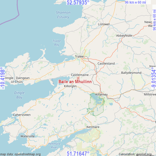
Baile an Mhuilinn GPS coordinates[2]
52° 9' 0" North, 9° 43' 0.012" West
| Map corner | latitude | longitude |
|---|---|---|
| Upper-left | 52.57935°, | -10.4198° |
| Center: | 52.15°, | -9.71667° |
| Lower-right: | 51.71647°, | -9.01354° |
| Map W x H: | 95.9×95.9 km | = 59.6×59.6mi |
| max Lat: | 55.25° ⇑89.8% North |
| Baile an Mhuilinn: | 52.15° |
| min Lat: | ⇓10.2% South 51.52487° |
| min Long | Baile an Mhuili | max Long |
| -10.26889° | -9.71667° | -6.04944° |
| W 2.3%⇐ | ⇒97.7% E |
Elevation
Elevation of Baile an Mhuilinn is 14 m = 46 ft, and this is 40.5 m = 133 ft below average elevation for this country.
| Max E: |
262 m = 860 ft | 83.9% |
| Avg. | 54.5 m = 179 ft | |
| Baile an Mhuilinn | 14 m = 46 ft | |
Min E: |
0 m = 0 ft | 16.1% |
See also: Ireland elevation on elevation.city.
Geographical zone
Baile an Mhuilinn is located in North temperate zone (between Tropic of Cancer and the Arctic Circle). Distance of this North polar circle is 1602.6 km =995.8 mi to North.| Distance of | km | miles | from Baile an Mhuilinn |
|---|---|---|---|
| North Pole | 4208.5 | 2615 | to North |
| Arctic Circle | 1602.6 | 995.8 | to North |
| Tropic Cancer | 3192.6 | 1983.8 | to South |
| Equator | 5798.5 | 3603 | to South |


Nearby cities:
15 places around Baile an Mhuilinn: (largest is in red/bold)
• Abbeyfeale
38.2 km =23.7 mi,  47°
47°
• Ardfert
19.6 km =12.2 mi,  347°
347°
• Ballybunnion
40.3 km =25 mi,  4°
4°
• Ballyduff
33.7 km =20.9 mi,  6°
6°
• Ballyheige
27.1 km =16.8 mi,  342°
342°
• Castleisland
19.4 km =12.1 mi,  61°
61°
• Cill Airne
17.4 km =10.8 mi,  125°
125°
• Dingle
37.7 km =23.4 mi,  268°
268°
• Fenit
17.8 km =11.1 mi,  324°
324°
• Kenmare
31 km =19.3 mi,  162°
162°
• Killorglin
7.2 km =4.5 mi,  219°
219°
• Listowel
36.5 km =22.7 mi,  25°
25°
• Lixnaw
29.2 km =18.1 mi, 13°
• Rathmore
34.9 km =21.7 mi,  102°
102°
• Tralee
13.4 km =8.3 mi, 4°
Sources, notices
• [Note1] Compared only with cities in Ireland existing in our database
• [Src1] Map data: © OpenStreetMap contributors (CC-BY-SA)
• [Src2] Other city data from geonames.org with taken over terms of usage.
• [Src3] Geographical zone / Annual Mean Temperature by Robert A. Rohde @ Wikipedia
