Athenry geodata
Athenry (Connaught) is a populated place; located in Ireland in Europe/Dublin (GMT+1) time zone. With population of 3,950 people, there are 162 cities with bigger population in this country. Compared to other cities in Ireland, 55.4% of cities are located further ↓South; 83.1% of cities are located further →East and 62.2% of cities have higher elevation than Athenry. Note1


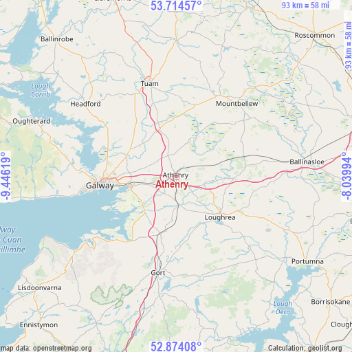
Athenry GPS coordinates[2]
53° 17' 47.004" North, 8° 44' 35.016" West
| Map corner | latitude | longitude |
|---|---|---|
| Upper-left | 53.71457°, | -9.44619° |
| Center: | 53.29639°, | -8.74306° |
| Lower-right: | 52.87408°, | -8.03994° |
| Map W x H: | 93.5×93.5 km | = 58.1×58.1mi |
| max Lat: | 55.25° ⇑44.6% North |
| Athenry: | 53.29639° |
| min Lat: | ⇓55.4% South 51.52487° |
| min Long | Athenry | max Long |
| -10.26889° | -8.74306° | -6.04944° |
| W 16.9%⇐ | ⇒83.1% E |
Elevation
Elevation of Athenry is 35 m = 115 ft, and this is 19.5 m = 64 ft below average elevation for this country.
| Max E: |
262 m = 860 ft | 62.2% |
| Avg. | 54.5 m = 179 ft | |
| Athenry | 35 m = 115 ft | |
Min E: |
0 m = 0 ft | 37.8% |
See also: Ireland elevation on elevation.city.
Geographical zone
Athenry is located in North temperate zone (between Tropic of Cancer and the Arctic Circle). Distance of this North polar circle is 1475.2 km =916.6 mi to North.| Distance of | km | miles | from Athenry |
|---|---|---|---|
| North Pole | 4081.1 | 2535.9 | to North |
| Arctic Circle | 1475.2 | 916.6 | to North |
| Tropic Cancer | 3320.1 | 2063 | to South |
| Equator | 5926 | 3682.2 | to South |


Nearby cities:
15 places around Athenry: (largest is in red/bold)
• Bearna
27.5 km =17.1 mi,  259°
259°
• Claregalway
14.2 km =8.8 mi,  289°
289°
• Corrofin
17.7 km =11 mi,  332°
332°
• Craughwell
7.8 km =4.8 mi,  175°
175°
• Gaillimh
20.5 km =12.7 mi, 262°
• Gort
26 km =16.2 mi,  190°
190°
• Headford
30.3 km =18.8 mi,  308°
308°
• Kinvarra
21.6 km =13.4 mi,  216°
216°
• Lackagh
12 km =7.5 mi, 310°
• Loughrea
16.1 km =10 mi,  133°
133°
• Mountbellew
25.1 km =15.6 mi,  39°
39°
• Moycullen
29.4 km =18.3 mi,  279°
279°
• Moylough
23.9 km =14.9 mi,  29°
29°
• Oranmore
12.2 km =7.6 mi, 255°
• Tuam
25.5 km =15.8 mi,  343°
343°
Sources, notices
• [Note1] Compared only with cities in Ireland existing in our database
• [Src1] Map data: © OpenStreetMap contributors (CC-BY-SA)
• [Src2] Other city data from geonames.org with taken over terms of usage.
• [Src3] Geographical zone / Annual Mean Temperature by Robert A. Rohde @ Wikipedia
