Corrofin geodata
Corrofin (Connaught) is a populated place; located in Ireland in Europe/Dublin (GMT+1) time zone. With population of 549 people, there are 500 cities with bigger population in this country. Compared to other cities in Ireland, 69.1% of cities are located further ↓South; 85.4% of cities are located further →East and 63% of cities have higher elevation than Corrofin. Note1


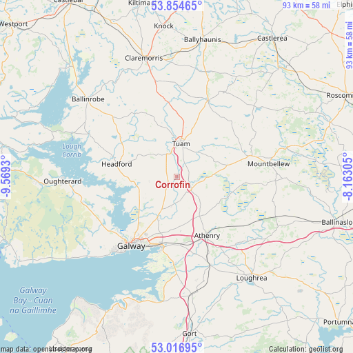
Corrofin GPS coordinates[2]
53° 26' 16.296" North, 8° 51' 58.212" West
| Map corner | latitude | longitude |
|---|---|---|
| Upper-left | 53.85465°, | -9.5693° |
| Center: | 53.43786°, | -8.86617° |
| Lower-right: | 53.01695°, | -8.16305° |
| Map W x H: | 93.1×93.1 km | = 57.8×57.8mi |
| max Lat: | 55.25° ⇑30.9% North |
| Corrofin: | 53.43786° |
| min Lat: | ⇓69.1% South 51.52487° |
| min Long | Corrofin | max Long |
| -10.26889° | -8.86617° | -6.04944° |
| W 14.6%⇐ | ⇒85.4% E |
Elevation
Elevation of Corrofin is 33 m = 108 ft, and this is 21.5 m = 71 ft below average elevation for this country.
| Max E: |
262 m = 860 ft | 63% |
| Avg. | 54.5 m = 179 ft | |
| Corrofin | 33 m = 108 ft | |
Min E: |
0 m = 0 ft | 37% |
See also: Ireland elevation on elevation.city.
Geographical zone
Corrofin is located in North temperate zone (between Tropic of Cancer and the Arctic Circle). Distance of this North polar circle is 1459.4 km =906.8 mi to North.| Distance of | km | miles | from Corrofin |
|---|---|---|---|
| North Pole | 4065.3 | 2526.1 | to North |
| Arctic Circle | 1459.4 | 906.8 | to North |
| Tropic Cancer | 3335.8 | 2072.8 | to South |
| Equator | 5941.7 | 3692 | to South |


Nearby cities:
15 places around Corrofin: (largest is in red/bold)
• Athenry
17.7 km =11 mi,  152°
152°
• Bearna
28 km =17.4 mi,  222°
222°
• Claregalway
12.2 km =7.6 mi,  205°
205°
• Claremorris
32.2 km =20 mi,  344°
344°
• Craughwell
25.1 km =15.6 mi,  159°
159°
• Dunmore
21.7 km =13.5 mi,  23°
23°
• Gaillimh
22.1 km =13.7 mi, 213°
• Headford
15.8 km =9.8 mi,  281°
281°
• Lackagh
7.9 km =4.9 mi,  186°
186°
• Mountbellew
24.3 km =15.1 mi,  81°
81°
• Moycullen
23.6 km =14.7 mi,  241°
241°
• Moylough
20.5 km =12.7 mi, 75°
• Oranmore
19.2 km =11.9 mi, 190°
• Oughterard
31 km =19.3 mi,  265°
265°
• Tuam
8.8 km =5.5 mi,  6°
6°
Sources, notices
• [Note1] Compared only with cities in Ireland existing in our database
• [Src1] Map data: © OpenStreetMap contributors (CC-BY-SA)
• [Src2] Other city data from geonames.org with taken over terms of usage.
• [Src3] Geographical zone / Annual Mean Temperature by Robert A. Rohde @ Wikipedia
