Nirit geodata
Nirit (Central District) is a populated place; located in Israel in Asia/Jerusalem (GMT+3) time zone. With population of 1,132 people, there are 154 cities with bigger population in this country. Compared to other cities in Israel, 55.6% of cities are located further ↑North; 59.8% of cities are located further →East and 50.3% of cities have higher elevation than Nirit. Note1


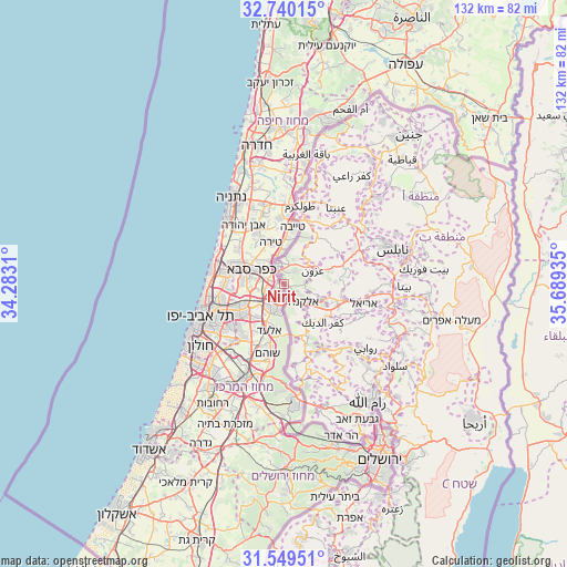
Nirit GPS coordinates[2]
32° 8' 48.372" North, 34° 59' 10.392" East
| Map corner | latitude | longitude |
|---|---|---|
| Upper-left | 32.74015°, | 34.2831° |
| Center: | 32.14677°, | 34.98622° |
| Lower-right: | 31.54951°, | 35.68935° |
| Map W x H: | 132.4×132.4 km | = 82.3×82.3mi |
| max Lat: | 33.27918° ⇑55.6% North |
| Nirit: | 32.14677° |
| min Lat: | ⇓44.4% South 29.55805° |
| min Long | Nirit | max Long |
| 34.57149° | 34.98622° | 35.81084° |
| W 40.2%⇐ | ⇒59.8% E |
Elevation
Elevation of Nirit is 117 m = 384 ft, and this is 106.4 m = 349 ft below average elevation for this country.
| Max E: |
988 m = 3241 ft | 50.3% |
| Avg. | 223.4 m = 733 ft | |
| Nirit | 117 m = 384 ft | |
Min E: |
-380 m = -1247 ft | 49.7% |
See also: Israel elevation on elevation.city.
Geographical zone
Nirit is located in North temperate zone (between Tropic of Cancer and the Arctic Circle). Distance of this Northern Tropic circle is 968.5 km =601.8 mi to South.| Distance of | km | miles | from Nirit |
|---|---|---|---|
| North Pole | 6432.7 | 3997.1 | to North |
| Arctic Circle | 3826.8 | 2377.9 | to North |
| Tropic Cancer | 968.5 | 601.8 | to South |
| Equator | 3574.4 | 2221 | to South |


Nearby cities:
15 places around Nirit: (largest is in red/bold)
• Eṭ Ṭaiyiba
13.4 km =8.3 mi,  9°
9°
• Ganei Tikva
14.4 km =8.9 mi,  227°
227°
• Hod HaSharon
8.9 km =5.5 mi,  279°
279°
• Jaljūlya
3.2 km =2 mi,  286°
286°
• Kafr Qāsim
3.8 km =2.4 mi,  194°
194°
• Kfar Saba
8.1 km =5 mi, 292°
• Kiryat Netafim
12.3 km =7.6 mi,  105°
105°
• Neẖalim
12 km =7.5 mi,  216°
216°
• Petaẖ Tiqwa
11.4 km =7.1 mi, 234°
• Ra'anana
11.3 km =7 mi, 291°
• Ramat HaSharon
13.8 km =8.6 mi,  269°
269°
• Revava
13.8 km =8.6 mi,  102°
102°
• Rosh Ha‘Ayin
6.3 km =3.9 mi,  206°
206°
• Tel Mond
13.2 km =8.2 mi,  330°
330°
• Tirah
10.3 km =6.4 mi,  340°
340°
Sources, notices
• [Note1] Compared only with cities in Israel existing in our database
• [Src1] Map data: © OpenStreetMap contributors (CC-BY-SA)
• [Src2] Other city data from geonames.org with taken over terms of usage.
• [Src3] Geographical zone / Annual Mean Temperature by Robert A. Rohde @ Wikipedia
