Kābūl geodata
Kābūl (Northern District) is a populated place; located in Israel in Asia/Jerusalem (GMT+3) time zone. With population of 9,497 people, there are 89 cities with bigger population in this country. Compared to other cities in Israel, 83.4% of cities are located further ↓South; 68.6% of cities are located further ←West and 53.3% of cities have higher elevation than Kābūl. Note1


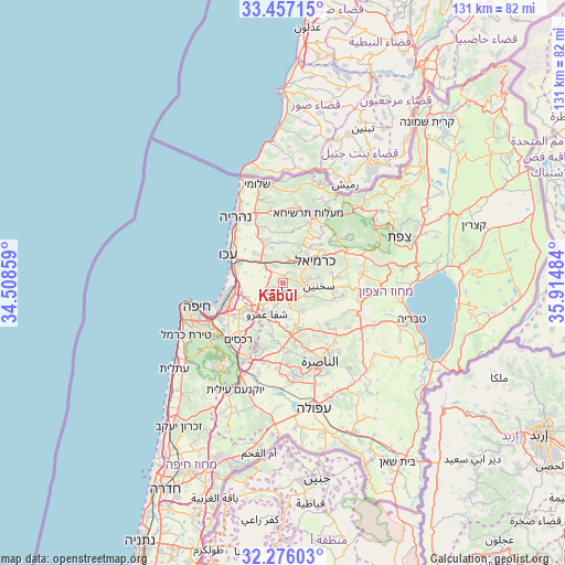
Kābūl GPS coordinates[2]
32° 52' 6.816" North, 35° 12' 42.156" East
| Map corner | latitude | longitude |
|---|---|---|
| Upper-left | 33.45715°, | 34.50859° |
| Center: | 32.86856°, | 35.21171° |
| Lower-right: | 32.27603°, | 35.91484° |
| Map W x H: | 131.3×131.3 km | = 81.6×81.6mi |
| max Lat: | 33.27918° ⇑16.6% North |
| Kābūl: | 32.86856° |
| min Lat: | ⇓83.4% South 29.55805° |
| min Long | Kābūl | max Long |
| 34.57149° | 35.21171° | 35.81084° |
| W 68.6%⇐ | ⇒31.4% E |
Elevation
Elevation of Kābūl is 92 m = 302 ft, and this is 131.4 m = 431 ft below average elevation for this country.
| Max E: |
988 m = 3241 ft | 53.3% |
| Avg. | 223.4 m = 733 ft | |
| Kābūl | 92 m = 302 ft | |
Min E: |
-380 m = -1247 ft | 46.7% |
See also: Israel elevation on elevation.city.
Geographical zone
Kābūl is located in North temperate zone (between Tropic of Cancer and the Arctic Circle). Distance of this Northern Tropic circle is 1048.7 km =651.6 mi to South.| Distance of | km | miles | from Kābūl |
|---|---|---|---|
| North Pole | 6352.4 | 3947.2 | to North |
| Arctic Circle | 3746.5 | 2328 | to North |
| Tropic Cancer | 1048.7 | 651.6 | to South |
| Equator | 3654.6 | 2270.9 | to South |


Nearby cities:
15 places around Kābūl: (largest is in red/bold)
• Bīr el Maksūr
10.2 km =6.3 mi,  175°
175°
• Judeida Makr
8.4 km =5.2 mi,  322°
322°
• Kafr Mandā
7.9 km =4.9 mi,  145°
145°
• Karmi’el
10.2 km =6.3 mi,  58°
58°
• Kaukab Abū el Hījā
5.4 km =3.4 mi,  140°
140°
• Kfar Yasif
10.6 km =6.6 mi,  334°
334°
• Naḥf
12.2 km =7.6 mi,  53°
53°
• Qiryat Ata
11.2 km =7 mi,  235°
235°
• Qiryat Bialik
12.6 km =7.8 mi,  248°
248°
• Qiryat Moẕqin
13 km =8.1 mi, 254°
• Qiryat Yam
13.4 km =8.3 mi,  260°
260°
• Rumat Heib
13.4 km =8.3 mi, 138°
• Sakhnīn
8 km =5 mi,  93°
93°
• Tamra
2.1 km =1.3 mi,  215°
215°
• ‘Uzeir
13.9 km =8.6 mi,  127°
127°
Sources, notices
• [Note1] Compared only with cities in Israel existing in our database
• [Src1] Map data: © OpenStreetMap contributors (CC-BY-SA)
• [Src2] Other city data from geonames.org with taken over terms of usage.
• [Src3] Geographical zone / Annual Mean Temperature by Robert A. Rohde @ Wikipedia
