Ibṭīn geodata
Ibṭīn (Haifa) is a populated place; located in Israel in Asia/Jerusalem (GMT+3) time zone. With population of 2,020 people, there are 141 cities with bigger population in this country. Compared to other cities in Israel, 72.2% of cities are located further ↓South; 57.4% of cities are located further ←West and 52.1% of cities have higher elevation than Ibṭīn. Note1


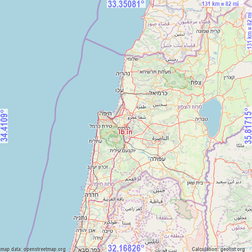
Ibṭīn GPS coordinates[2]
32° 45' 41.4" North, 35° 6' 50.472" East
| Map corner | latitude | longitude |
|---|---|---|
| Upper-left | 33.35081°, | 34.4109° |
| Center: | 32.7615°, | 35.11402° |
| Lower-right: | 32.16826°, | 35.81715° |
| Map W x H: | 131.5×131.5 km | = 81.7×81.7mi |
| max Lat: | 33.27918° ⇑27.8% North |
| Ibṭīn: | 32.7615° |
| min Lat: | ⇓72.2% South 29.55805° |
| min Long | Ibṭīn | max Long |
| 34.57149° | 35.11402° | 35.81084° |
| W 57.4%⇐ | ⇒42.6% E |
Elevation
Elevation of Ibṭīn is 93 m = 305 ft, and this is 130.4 m = 428 ft below average elevation for this country.
| Max E: |
988 m = 3241 ft | 52.1% |
| Avg. | 223.4 m = 733 ft | |
| Ibṭīn | 93 m = 305 ft | |
Min E: |
-380 m = -1247 ft | 47.9% |
See also: Israel elevation on elevation.city.
Geographical zone
Ibṭīn is located in North temperate zone (between Tropic of Cancer and the Arctic Circle). Distance of this Northern Tropic circle is 1036.8 km =644.2 mi to South.| Distance of | km | miles | from Ibṭīn |
|---|---|---|---|
| North Pole | 6364.3 | 3954.6 | to North |
| Arctic Circle | 3758.4 | 2335.4 | to North |
| Tropic Cancer | 1036.8 | 644.2 | to South |
| Equator | 3642.7 | 2263.5 | to South |


Nearby cities:
15 places around Ibṭīn: (largest is in red/bold)
• Basmat Ṭab‘ūn
4.7 km =2.9 mi,  121°
121°
• Bīr el Maksūr
10.1 km =6.3 mi,  79°
79°
• Daliyat al Karmel
9.8 km =6.1 mi,  219°
219°
• Haifa
13.3 km =8.3 mi,  298°
298°
• Kafr Mandā
14.7 km =9.1 mi,  68°
68°
• Nesher
6.5 km =4 mi,  274°
274°
• Qiryat Ata
5.6 km =3.5 mi,  359°
359°
• Qiryat Bialik
7.8 km =4.8 mi,  340°
340°
• Qiryat Moẕqin
9.1 km =5.7 mi, 337°
• Qiryat Yam
10.6 km =6.6 mi, 337°
• Ramat Yishay
8.3 km =5.2 mi,  140°
140°
• Rekhasim
2 km =1.2 mi,  225°
225°
• Tamra
12.9 km =8 mi,  37°
37°
• Timrat
12.1 km =7.5 mi, 122°
• Tirat Karmel
13.3 km =8.3 mi, 269°
Sources, notices
• [Note1] Compared only with cities in Israel existing in our database
• [Src1] Map data: © OpenStreetMap contributors (CC-BY-SA)
• [Src2] Other city data from geonames.org with taken over terms of usage.
• [Src3] Geographical zone / Annual Mean Temperature by Robert A. Rohde @ Wikipedia
