Vīrarājendrapet geodata
Vīrarājendrapet (Karnataka) is a populated place; located in India in Asia/Kolkata (GMT+5.5) time zone. With population of 15,976 people, there are 2371 cities with bigger population in this country. Compared to other cities in India, 89.3% of cities are located further ↑North; 75.6% of cities are located further →East and 95.3% of cities have lower elevation than Vīrarājendrapet. Note1


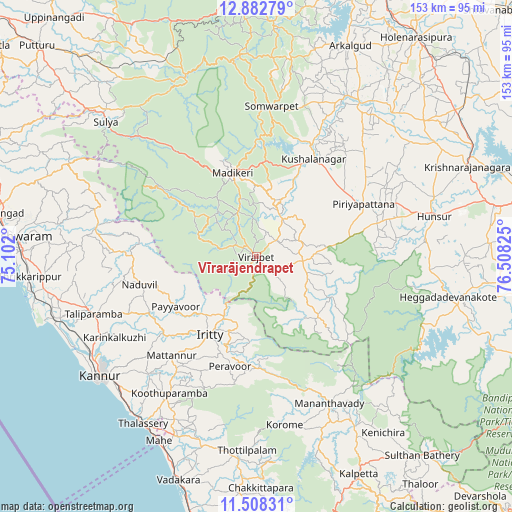
Vīrarājendrapet GPS coordinates[2]
12° 11' 47.184" North, 75° 48' 18.432" East
| Map corner | latitude | longitude |
|---|---|---|
| Upper-left | 12.88279°, | 75.102° |
| Center: | 12.19644°, | 75.80512° |
| Lower-right: | 11.50831°, | 76.50825° |
| Map W x H: | 152.8×152.8 km | = 94.9×94.9mi |
| max Lat: | 34.9274° ⇑89.3% North |
| Vīrarājendrapet: | 12.19644° |
| min Lat: | ⇓10.7% South 8.09008° |
| min Long | Vīrarājendrap | max Long |
| 68.82655° | 75.80512° | 96.81° |
| W 24.4%⇐ | ⇒75.6% E |
Elevation
Elevation of Vīrarājendrapet is 899 m = 2949 ft, and this is 603.4 m = 1980 ft above average elevation for this country.
| Max E: |
3681 m = 12077 ft | 4.7% |
| Vīrarājendrapet | 899 m 2949 ft | |
| Avg. | 295.6 m = 970 ft | |
Min E: |
1 m = 3 ft | 95.3% |
See also: India elevation on elevation.city.
Geographical zone
Vīrarājendrapet is located in North Torrid zone (between Equator and Tropic of Cancer). Distance of this Northern Tropic circle is 1249.8 km =776.6 mi to North.| Distance of | km | miles | from Vīrarājendrapet |
|---|---|---|---|
| North Pole | 8650.9 | 5375.4 | to North |
| Arctic Circle | 6045.1 | 3756.2 | to North |
| Tropic Cancer | 1249.8 | 776.6 | to North |
| Equator | 1356.1 | 842.6 | to South |


Nearby cities:
15 places around Vīrarājendrapet: (largest is in red/bold)
• Heggadadevankote
58.3 km =36.2 mi,  101°
101°
• Hunsūr
54.3 km =33.7 mi,  77°
77°
• Kannavam
42.1 km =26.2 mi,  201°
201°
• Konanūr
55.1 km =34.2 mi,  28°
28°
• Kushālnagar
33.5 km =20.8 mi, 29°
• Madikeri
26.5 km =16.5 mi,  344°
344°
• Mattanur
39 km =24.2 mi,  220°
220°
• Panamaram
58.5 km =36.4 mi,  150°
150°
• Perya
40.7 km =25.3 mi,  172°
172°
• Piriyāpatna
35.6 km =22.1 mi,  64°
64°
• Ponnampet
16.3 km =10.1 mi,  110°
110°
• Pāppinisshēri
57.1 km =35.5 mi,  242°
242°
• Somvārpet
44.8 km =27.8 mi,  6°
6°
• Suntikoppa
29 km =18 mi, 5°
• Talipparamba
51.4 km =31.9 mi,  250°
250°
Sources, notices
• [Note1] Compared only with cities in India existing in our database
• [Src1] Map data: © OpenStreetMap contributors (CC-BY-SA)
• [Src2] Other city data from geonames.org with taken over terms of usage.
• [Src3] Geographical zone / Annual Mean Temperature by Robert A. Rohde @ Wikipedia
