Mattanur geodata
Mattanur (Kerala) is a populated place; located in India in Asia/Kolkata (GMT+5.5) time zone. With population of 45,521 people, there are 971 cities with bigger population in this country. Compared to other cities in India, 90% of cities are located further ↑North; 77.9% of cities are located further →East and 79.2% of cities have higher elevation than Mattanur. Note1


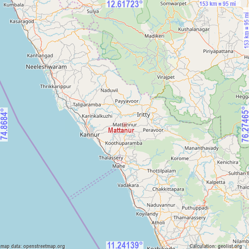
Mattanur GPS coordinates[2]
11° 55' 48.648" North, 75° 34' 17.472" East
| Map corner | latitude | longitude |
|---|---|---|
| Upper-left | 12.61723°, | 74.8684° |
| Center: | 11.93018°, | 75.57152° |
| Lower-right: | 11.24139°, | 76.27465° |
| Map W x H: | 153×153 km | = 95.1×95.1mi |
| max Lat: | 34.9274° ⇑90% North |
| Mattanur: | 11.93018° |
| min Lat: | ⇓10% South 8.09008° |
| min Long | Mattanur | max Long |
| 68.82655° | 75.57152° | 96.81° |
| W 22.1%⇐ | ⇒77.9% E |
Elevation
Elevation of Mattanur is 51 m = 167 ft, and this is 244.6 m = 802 ft below average elevation for this country.
| Max E: |
3681 m = 12077 ft | 79.2% |
| Avg. | 295.6 m = 970 ft | |
| Mattanur | 51 m = 167 ft | |
Min E: |
1 m = 3 ft | 20.8% |
See also: Mattanur elevation on elevation.city.
Geographical zone
Mattanur is located in North Torrid zone (between Equator and Tropic of Cancer). Distance of this Northern Tropic circle is 1279.4 km =795 mi to North.| Distance of | km | miles | from Mattanur |
|---|---|---|---|
| North Pole | 8680.6 | 5393.9 | to North |
| Arctic Circle | 6074.7 | 3774.6 | to North |
| Tropic Cancer | 1279.4 | 795 | to North |
| Equator | 1326.5 | 824.2 | to South |


Nearby cities:
15 places around Mattanur: (largest is in red/bold)
• Azhikkal
24.4 km =15.2 mi,  266°
266°
• Badagara
37 km =23 mi,  178°
178°
• Dharmadam
20.8 km =12.9 mi,  214°
214°
• Iringal
41.5 km =25.8 mi,  173°
173°
• Kannavam
13.8 km =8.6 mi,  133°
133°
• Kannur
24.3 km =15.1 mi,  253°
253°
• Mahē
25.7 km =16 mi,  188°
188°
• Muluppilagadu
19.7 km =12.2 mi,  221°
221°
• Nādāpuram
28.8 km =17.9 mi,  161°
161°
• Payyannūr
44.1 km =27.4 mi,  294°
294°
• Perya
32.6 km =20.3 mi,  109°
109°
• Pāppinisshēri
25.3 km =15.7 mi,  276°
276°
• Talipparamba
26.2 km =16.3 mi,  298°
298°
• Tellicherry
22 km =13.7 mi,  202°
202°
• Vīrarājendrapet
39 km =24.2 mi,  40°
40°
Sources, notices
• [Note1] Compared only with cities in India existing in our database
• [Src1] Map data: © OpenStreetMap contributors (CC-BY-SA)
• [Src2] Other city data from geonames.org with taken over terms of usage.
• [Src3] Geographical zone / Annual Mean Temperature by Robert A. Rohde @ Wikipedia
