Naya Bāzār geodata
Naya Bāzār (Sikkim) is a populated place; located in India in Asia/Kolkata (GMT+5.5) time zone. With population of 1,035 people, there are 3460 cities with bigger population in this country. Compared to other cities in India, 79.4% of cities are located further ↓South; 92.2% of cities are located further ←West and 95.6% of cities have lower elevation than Naya Bāzār. Note1


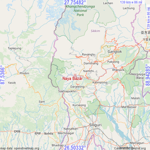
Naya Bāzār GPS coordinates[2]
27° 7' 50.952" North, 88° 14' 22.992" East
| Map corner | latitude | longitude |
|---|---|---|
| Upper-left | 27.75482°, | 87.5366° |
| Center: | 27.13082°, | 88.23972° |
| Lower-right: | 26.50332°, | 88.94285° |
| Map W x H: | 139.2×139.2 km | = 86.5×86.5mi |
| max Lat: | 34.9274° ⇑20.6% North |
| Naya Bāzār: | 27.13082° |
| min Lat: | ⇓79.4% South 8.09008° |
| min Long | Naya Bāzār | max Long |
| 68.82655° | 88.23972° | 96.81° |
| W 92.2%⇐ | ⇒7.8% E |
Elevation
Elevation of Naya Bāzār is 927 m = 3041 ft, and this is 631.4 m = 2072 ft above average elevation for this country.
| Max E: |
3681 m = 12077 ft | 4.4% |
| Naya Bāzār | 927 m 3041 ft | |
| Avg. | 295.6 m = 970 ft | |
Min E: |
1 m = 3 ft | 95.6% |
See also: India elevation on elevation.city.
Geographical zone
Naya Bāzār is located in North temperate zone (between Tropic of Cancer and the Arctic Circle). Distance of this Northern Tropic circle is 410.7 km =255.2 mi to South.| Distance of | km | miles | from Naya Bāzār |
|---|---|---|---|
| North Pole | 6990.4 | 4343.6 | to North |
| Arctic Circle | 4384.5 | 2724.4 | to North |
| Tropic Cancer | 410.7 | 255.2 | to South |
| Equator | 3016.7 | 1874.5 | to South |


Nearby cities:
15 places around Naya Bāzār: (largest is in red/bold)
• Bagdogra
48.5 km =30.1 mi,  171°
171°
• Dārjiling
11.2 km =7 mi, 166°
• Gangtok
42.7 km =26.5 mi,  59°
59°
• Gyalshing
17.7 km =11 mi,  5°
5°
• Jorethang
8.7 km =5.4 mi,  107°
107°
• Kalimpong, Крукети
23.5 km =14.6 mi, 110°
• Kālimpong
24.3 km =15.1 mi, 106°
• Kārsiyāng
27.9 km =17.3 mi, 172°
• Mangan
50.5 km =31.4 mi,  33°
33°
• Mirik
27.4 km =17 mi,  190°
190°
• Naksalbāri
49.9 km =31 mi,  182°
182°
• Namchi
12.8 km =8 mi,  72°
72°
• Rangpo
29.5 km =18.3 mi,  79°
79°
• Siliguri
50.4 km =31.3 mi,  158°
158°
• Singtam
28.4 km =17.6 mi, 65°
Sources, notices
• [Note1] Compared only with cities in India existing in our database
• [Src1] Map data: © OpenStreetMap contributors (CC-BY-SA)
• [Src2] Other city data from geonames.org with taken over terms of usage.
• [Src3] Geographical zone / Annual Mean Temperature by Robert A. Rohde @ Wikipedia
