Londa geodata
Londa (Karnataka) is a populated place; located in India in Asia/Kolkata (GMT+5.5) time zone. With population of 6,131 people, there are 3276 cities with bigger population in this country. Compared to other cities in India, 79.9% of cities are located further ↑North; 86.7% of cities are located further →East and 91.9% of cities have lower elevation than Londa. Note1


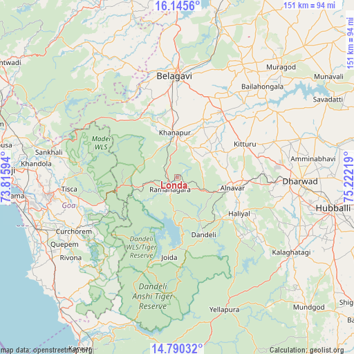
Londa GPS coordinates[2]
15° 28' 8.652" North, 74° 31' 8.616" East
| Map corner | latitude | longitude |
|---|---|---|
| Upper-left | 16.1456°, | 73.81594° |
| Center: | 15.46907°, | 74.51906° |
| Lower-right: | 14.79032°, | 75.22219° |
| Map W x H: | 150.7×150.7 km | = 93.6×93.6mi |
| max Lat: | 34.9274° ⇑79.9% North |
| Londa: | 15.46907° |
| min Lat: | ⇓20.1% South 8.09008° |
| min Long | Londa | max Long |
| 68.82655° | 74.51906° | 96.81° |
| W 13.3%⇐ | ⇒86.7% E |
Elevation
Elevation of Londa is 682 m = 2238 ft, and this is 386.4 m = 1268 ft above average elevation for this country.
| Max E: |
3681 m = 12077 ft | 8.1% |
| Londa | 682 m 2238 ft | |
| Avg. | 295.6 m = 970 ft | |
Min E: |
1 m = 3 ft | 91.9% |
See also: India elevation on elevation.city.
Geographical zone
Londa is located in North Torrid zone (between Equator and Tropic of Cancer). Distance of this Northern Tropic circle is 885.9 km =550.5 mi to North.| Distance of | km | miles | from Londa |
|---|---|---|---|
| North Pole | 8287.1 | 5149.4 | to North |
| Arctic Circle | 5681.2 | 3530.1 | to North |
| Tropic Cancer | 885.9 | 550.5 | to North |
| Equator | 1720 | 1068.8 | to South |


Nearby cities:
15 places around Londa: (largest is in red/bold)
• Alnāvar
24.2 km =15 mi,  101°
101°
• Bail-Hongal
52.8 km =32.8 mi,  43°
43°
• Belgaum
42.6 km =26.5 mi,  357°
357°
• Curchorem
49.6 km =30.8 mi,  242°
242°
• Curti
54.2 km =33.7 mi,  263°
263°
• Dandeli
24.8 km =15.4 mi,  155°
155°
• Haliyal
29.8 km =18.5 mi,  121°
121°
• Khānāpur
19 km =11.8 mi, 356°
• Palle
46.7 km =29 mi,  269°
269°
• Ponda
54.5 km =33.9 mi, 262°
• Quepem
55.3 km =34.4 mi, 238°
• Sanguem
47.6 km =29.6 mi, 235°
• Sanquelim
55.8 km =34.7 mi,  280°
280°
• Sanvordem
48.6 km =30.2 mi, 241°
• Valpoy
41.6 km =25.8 mi, 279°
Sources, notices
• [Note1] Compared only with cities in India existing in our database
• [Src1] Map data: © OpenStreetMap contributors (CC-BY-SA)
• [Src2] Other city data from geonames.org with taken over terms of usage.
• [Src3] Geographical zone / Annual Mean Temperature by Robert A. Rohde @ Wikipedia
