Kudāl geodata
Kudāl (Maharashtra) is a populated place; located in India in Asia/Kolkata (GMT+5.5) time zone. With population of 14,432 people, there are 2517 cities with bigger population in this country. Compared to other cities in India, 78.1% of cities are located further ↑North; 91.8% of cities are located further →East and 85.8% of cities have higher elevation than Kudāl. Note1


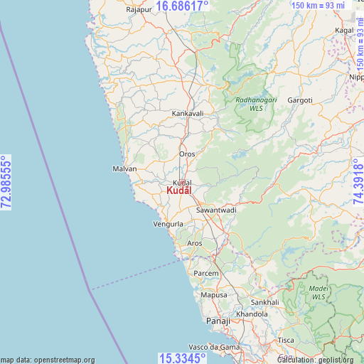
Kudāl GPS coordinates[2]
16° 0' 41.328" North, 73° 41' 19.212" East
| Map corner | latitude | longitude |
|---|---|---|
| Upper-left | 16.68617°, | 72.98555° |
| Center: | 16.01148°, | 73.68867° |
| Lower-right: | 15.3345°, | 74.3918° |
| Map W x H: | 150.3×150.3 km | = 93.4×93.4mi |
| max Lat: | 34.9274° ⇑78.1% North |
| Kudāl: | 16.01148° |
| min Lat: | ⇓21.9% South 8.09008° |
| min Long | Kudāl | max Long |
| 68.82655° | 73.68867° | 96.81° |
| W 8.2%⇐ | ⇒91.8% E |
Elevation
Elevation of Kudāl is 28 m = 92 ft, and this is 267.6 m = 878 ft below average elevation for this country.
| Max E: |
3681 m = 12077 ft | 85.8% |
| Avg. | 295.6 m = 970 ft | |
| Kudāl | 28 m = 92 ft | |
Min E: |
1 m = 3 ft | 14.2% |
See also: India elevation on elevation.city.
Geographical zone
Kudāl is located in North Torrid zone (between Equator and Tropic of Cancer). Distance of this Northern Tropic circle is 825.6 km =513 mi to North.| Distance of | km | miles | from Kudāl |
|---|---|---|---|
| North Pole | 8226.8 | 5111.9 | to North |
| Arctic Circle | 5620.9 | 3492.7 | to North |
| Tropic Cancer | 825.6 | 513 | to North |
| Equator | 1780.3 | 1106.2 | to South |


Nearby cities:
15 places around Kudāl: (largest is in red/bold)
• Aldona
50.6 km =31.4 mi,  156°
156°
• Arambol
36.1 km =22.4 mi,  177°
177°
• Baga
50.1 km =31.1 mi,  171°
171°
• Chapora
45.7 km =28.4 mi, 173°
• Colovale
44.3 km =27.5 mi, 160°
• Guirim
50.1 km =31.1 mi, 165°
• Kankauli
28.4 km =17.6 mi,  5°
5°
• Morjim
42.7 km =26.5 mi, 172°
• Mālvan
24.7 km =15.3 mi,  282°
282°
• Māpuca
48.4 km =30.1 mi, 164°
• Pernem
34 km =21.1 mi, 160°
• Solim
44.9 km =27.9 mi, 169°
• Sāvantvādi
18.6 km =11.6 mi,  129°
129°
• Vagator
46.4 km =28.8 mi, 172°
• Vengurla
17.8 km =11.1 mi,  199°
199°
Sources, notices
• [Note1] Compared only with cities in India existing in our database
• [Src1] Map data: © OpenStreetMap contributors (CC-BY-SA)
• [Src2] Other city data from geonames.org with taken over terms of usage.
• [Src3] Geographical zone / Annual Mean Temperature by Robert A. Rohde @ Wikipedia
