Kanniyākumāri geodata
Kanniyākumāri (Tamil Nadu) is a populated place; located in India in Asia/Kolkata (GMT+5.5) time zone. With population of 20,540 people, there are 1998 cities with bigger population in this country. Compared to other cities in India, 100% of cities are located further ↑North; 56.8% of cities are located further →East and 83.3% of cities have higher elevation than Kanniyākumāri. Note1


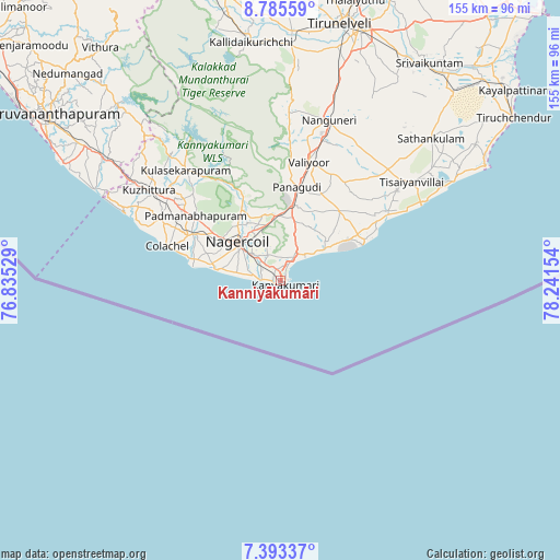
Kanniyākumāri GPS coordinates[2]
8° 5' 24.288" North, 77° 32' 18.276" East
| Map corner | latitude | longitude |
|---|---|---|
| Upper-left | 8.78559°, | 76.83529° |
| Center: | 8.09008°, | 77.53841° |
| Lower-right: | 7.39337°, | 78.24154° |
| Map W x H: | 154.8×154.8 km | = 96.2×96.2mi |
| max Lat: | 34.9274° ⇑100% North |
| Kanniyākumāri: | 8.09008° |
| min Lat: | ⇓0% South 8.09008° |
| min Long | Kanniyākumāri | max Long |
| 68.82655° | 77.53841° | 96.81° |
| W 43.2%⇐ | ⇒56.8% E |
Elevation
Elevation of Kanniyākumāri is 36 m = 118 ft, and this is 259.6 m = 852 ft below average elevation for this country.
| Max E: |
3681 m = 12077 ft | 83.3% |
| Avg. | 295.6 m = 970 ft | |
| Kanniyākumāri | 36 m = 118 ft | |
Min E: |
1 m = 3 ft | 16.7% |
See also: India elevation on elevation.city.
Geographical zone
Kanniyākumāri is located in North Torrid zone (between Equator and Tropic of Cancer). Distance of Equator is 899.5 km =558.9 mi to South.| Distance of | km | miles | from Kanniyākumāri |
|---|---|---|---|
| North Pole | 9107.5 | 5659.1 | to North |
| Arctic Circle | 6501.6 | 4039.9 | to North |
| Tropic Cancer | 1706.4 | 1060.3 | to North |
| Equator | 899.5 | 558.9 | to South |


Nearby cities:
15 places around Kanniyākumāri: (largest is in red/bold)
• Colachel
32.4 km =20.1 mi,  287°
287°
• Eraniel
27.5 km =17.1 mi,  297°
297°
• Kalakkādu
47.1 km =29.3 mi,  1°
1°
• Kallidaikurichi
66.7 km =41.4 mi,  353°
353°
• Kuzhithurai
45.8 km =28.5 mi, 303°
• Manavālakurichi
26.4 km =16.4 mi,  284°
284°
• Nanguneri
46.7 km =29 mi,  16°
16°
• Neyyāttinkara
60.5 km =37.6 mi, 304°
• Nāgercoil
15.3 km =9.5 mi,  310°
310°
• Padmanābhapuram
29 km =18 mi, 306°
• Sathankulam
56.8 km =35.3 mi,  46°
46°
• Suchindram
10.6 km =6.6 mi, 312°
• Tisaiyanvilai
45.5 km =28.3 mi, 52°
• Udangudi
65.9 km =40.9 mi,  55°
55°
• Vadakku Valliyūr
33.6 km =20.9 mi,  14°
14°
Sources, notices
• [Note1] Compared only with cities in India existing in our database
• [Src1] Map data: © OpenStreetMap contributors (CC-BY-SA)
• [Src2] Other city data from geonames.org with taken over terms of usage.
• [Src3] Geographical zone / Annual Mean Temperature by Robert A. Rohde @ Wikipedia
