Kuzhithurai geodata
Kuzhithurai (Tamil Nadu) is a populated place; located in India in Asia/Kolkata (GMT+5.5) time zone. With population of 20,611 people, there are 1994 cities with bigger population in this country. Compared to other cities in India, 99.8% of cities are located further ↑North; 61.1% of cities are located further →East and 77.5% of cities have higher elevation than Kuzhithurai. Note1


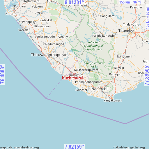
Kuzhithurai GPS coordinates[2]
8° 19' 4.512" North, 77° 11' 30.912" East
| Map corner | latitude | longitude |
|---|---|---|
| Upper-left | 9.01301°, | 76.4888° |
| Center: | 8.31792°, | 77.19192° |
| Lower-right: | 7.62159°, | 77.89505° |
| Map W x H: | 154.7×154.7 km | = 96.1×96.1mi |
| max Lat: | 34.9274° ⇑99.8% North |
| Kuzhithurai: | 8.31792° |
| min Lat: | ⇓0.2% South 8.09008° |
| min Long | Kuzhithurai | max Long |
| 68.82655° | 77.19192° | 96.81° |
| W 38.9%⇐ | ⇒61.1% E |
Elevation
Elevation of Kuzhithurai is 57 m = 187 ft, and this is 238.6 m = 783 ft below average elevation for this country.
| Max E: |
3681 m = 12077 ft | 77.5% |
| Avg. | 295.6 m = 970 ft | |
| Kuzhithurai | 57 m = 187 ft | |
Min E: |
1 m = 3 ft | 22.5% |
See also: India elevation on elevation.city.
Geographical zone
Kuzhithurai is located in North Torrid zone (between Equator and Tropic of Cancer). Distance of Equator is 924.9 km =574.7 mi to South.| Distance of | km | miles | from Kuzhithurai |
|---|---|---|---|
| North Pole | 9082.2 | 5643.4 | to North |
| Arctic Circle | 6476.3 | 4024.2 | to North |
| Tropic Cancer | 1681.1 | 1044.6 | to North |
| Equator | 924.9 | 574.7 | to South |


Nearby cities:
15 places around Kuzhithurai: (largest is in red/bold)
• Ambasamudram
52.2 km =32.4 mi,  33°
33°
• Colachel
17 km =10.6 mi,  154°
154°
• Eraniel
18.6 km =11.6 mi,  132°
132°
• Kalakkādu
45 km =28 mi,  61°
61°
• Kallidaikurichi
50.8 km =31.6 mi,  36°
36°
• Kanniyākumāri
45.8 km =28.5 mi,  123°
123°
• Kovalam
22.2 km =13.8 mi,  284°
284°
• Manavālakurichi
22.7 km =14.1 mi, 146°
• Nedumangād
38 km =23.6 mi,  326°
326°
• Neyyāttinkara
14.7 km =9.1 mi,  307°
307°
• Nāgercoil
30.6 km =19 mi, 120°
• Padmanābhapuram
16.8 km =10.4 mi, 118°
• Suchindram
35.3 km =21.9 mi, 120°
• Thiruvananthapuram
32.6 km =20.3 mi,  304°
304°
• Vadakku Valliyūr
46.8 km =29.1 mi,  81°
81°
Sources, notices
• [Note1] Compared only with cities in India existing in our database
• [Src1] Map data: © OpenStreetMap contributors (CC-BY-SA)
• [Src2] Other city data from geonames.org with taken over terms of usage.
• [Src3] Geographical zone / Annual Mean Temperature by Robert A. Rohde @ Wikipedia
