Neyyāttinkara geodata
Neyyāttinkara (Kerala) is a populated place; located in India in Asia/Kolkata (GMT+5.5) time zone. With population of 88,104 people, there are 507 cities with bigger population in this country. Compared to other cities in India, 99.7% of cities are located further ↑North; 62.2% of cities are located further →East and 86.4% of cities have higher elevation than Neyyāttinkara. Note1


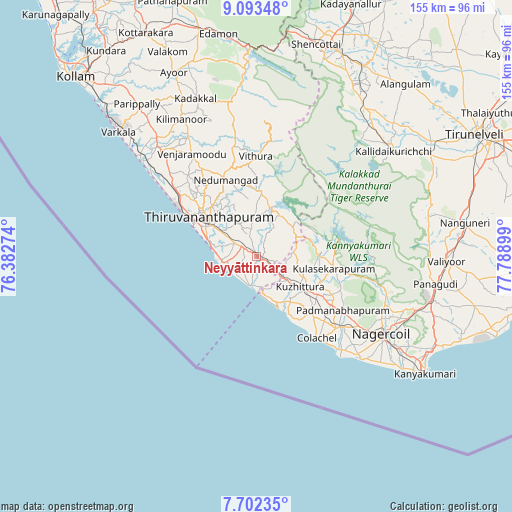
Neyyāttinkara GPS coordinates[2]
8° 23' 54.744" North, 77° 5' 9.096" East
| Map corner | latitude | longitude |
|---|---|---|
| Upper-left | 9.09348°, | 76.38274° |
| Center: | 8.39854°, | 77.08586° |
| Lower-right: | 7.70235°, | 77.78899° |
| Map W x H: | 154.7×154.7 km | = 96.1×96.1mi |
| max Lat: | 34.9274° ⇑99.7% North |
| Neyyāttinkara: | 8.39854° |
| min Lat: | ⇓0.3% South 8.09008° |
| min Long | Neyyāttinkara | max Long |
| 68.82655° | 77.08586° | 96.81° |
| W 37.8%⇐ | ⇒62.2% E |
Elevation
Elevation of Neyyāttinkara is 26 m = 85 ft, and this is 269.6 m = 885 ft below average elevation for this country.
| Max E: |
3681 m = 12077 ft | 86.4% |
| Avg. | 295.6 m = 970 ft | |
| Neyyāttinkara | 26 m = 85 ft | |
Min E: |
1 m = 3 ft | 13.6% |
See also: Neyyāttinkara elevation on elevation.city.
Geographical zone
Neyyāttinkara is located in North Torrid zone (between Equator and Tropic of Cancer). Distance of Equator is 933.8 km =580.2 mi to South.| Distance of | km | miles | from Neyyāttinkara |
|---|---|---|---|
| North Pole | 9073.2 | 5637.8 | to North |
| Arctic Circle | 6467.3 | 4018.6 | to North |
| Tropic Cancer | 1672.1 | 1039 | to North |
| Equator | 933.8 | 580.2 | to South |


Nearby cities:
15 places around Neyyāttinkara: (largest is in red/bold)
• Ambasamudram
53.1 km =33 mi,  49°
49°
• Attingal
44.5 km =27.7 mi,  318°
318°
• Colachel
30.9 km =19.2 mi,  142°
142°
• Eraniel
33.3 km =20.7 mi,  130°
130°
• Kadakkavoor
46.9 km =29.1 mi,  311°
311°
• Kalakkādu
52.6 km =32.7 mi,  75°
75°
• Kallidaikurichi
52.6 km =32.7 mi, 52°
• Kovalam
10.4 km =6.5 mi,  250°
250°
• Kuzhithurai
14.7 km =9.1 mi, 127°
• Manavālakurichi
36.9 km =22.9 mi, 139°
• Nedumangād
24.5 km =15.2 mi,  337°
337°
• Nāgercoil
45.3 km =28.1 mi,  122°
122°
• Padmanābhapuram
31.5 km =19.6 mi, 122°
• Suchindram
50 km =31.1 mi, 122°
• Thiruvananthapuram
17.9 km =11.1 mi,  302°
302°
Sources, notices
• [Note1] Compared only with cities in India existing in our database
• [Src1] Map data: © OpenStreetMap contributors (CC-BY-SA)
• [Src2] Other city data from geonames.org with taken over terms of usage.
• [Src3] Geographical zone / Annual Mean Temperature by Robert A. Rohde @ Wikipedia
