Hābra geodata
Hābra (West Bengal) is a populated place; located in India in Asia/Kolkata (GMT+5.5) time zone. With population of 139,297 people, there are 310 cities with bigger population in this country. Compared to other cities in India, 50.4% of cities are located further ↓South; 94.8% of cities are located further ←West and 93.5% of cities have higher elevation than Hābra. Note1


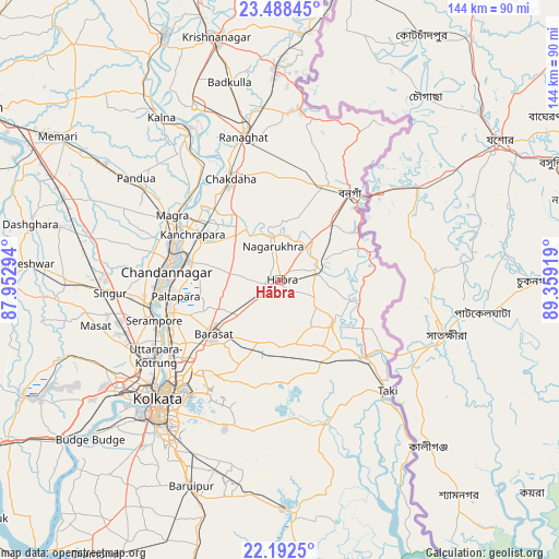
Hābra GPS coordinates[2]
22° 50' 31.272" North, 88° 39' 21.816" East
| Map corner | latitude | longitude |
|---|---|---|
| Upper-left | 23.48845°, | 87.95294° |
| Center: | 22.84202°, | 88.65606° |
| Lower-right: | 22.1925°, | 89.35919° |
| Map W x H: | 144.1×144.1 km | = 89.5×89.5mi |
| max Lat: | 34.9274° ⇑49.6% North |
| Hābra: | 22.84202° |
| min Lat: | ⇓50.4% South 8.09008° |
| min Long | Hābra | max Long |
| 68.82655° | 88.65606° | 96.81° |
| W 94.8%⇐ | ⇒5.2% E |
Elevation
Elevation of Hābra is 13 m = 43 ft, and this is 282.6 m = 927 ft below average elevation for this country.
| Max E: |
3681 m = 12077 ft | 93.5% |
| Avg. | 295.6 m = 970 ft | |
| Hābra | 13 m = 43 ft | |
Min E: |
1 m = 3 ft | 6.5% |
See also: Hābra elevation on elevation.city.
Geographical zone
Hābra is located in North Torrid zone (between Equator and Tropic of Cancer). Distance of this Northern Tropic circle is 66.1 km =41.1 mi to North.| Distance of | km | miles | from Hābra |
|---|---|---|---|
| North Pole | 7467.3 | 4640 | to North |
| Arctic Circle | 4861.4 | 3020.7 | to North |
| Tropic Cancer | 66.1 | 41.1 | to North |
| Equator | 2539.8 | 1578.2 | to South |


Nearby cities:
15 places around Hābra: (largest is in red/bold)
• Ashoknagar Kalyangarh
3.1 km =1.9 mi,  321°
321°
• Badūria
17.2 km =10.7 mi,  129°
129°
• Bhātpāra
26.3 km =16.3 mi,  275°
275°
• Bārāsat
22.3 km =13.9 mi,  233°
233°
• Gobārdānga
10.9 km =6.8 mi,  68°
68°
• Gurdaha
16 km =9.9 mi,  138°
138°
• Haringhāta
16 km =9.9 mi,  328°
328°
• Hālīsahar
26.3 km =16.3 mi,  292°
292°
• Kalyani
23.7 km =14.7 mi,  311°
311°
• Madanpur
24.8 km =15.4 mi, 317°
• Nagarukhra
11.2 km =7 mi,  349°
349°
• Naihāti
25.3 km =15.7 mi, 283°
• Rāmchandrapur
19.5 km =12.1 mi, 288°
• Sankarpur
21 km =13 mi,  271°
271°
• Ula
16.8 km =10.4 mi,  217°
217°
Sources, notices
• [Note1] Compared only with cities in India existing in our database
• [Src1] Map data: © OpenStreetMap contributors (CC-BY-SA)
• [Src2] Other city data from geonames.org with taken over terms of usage.
• [Src3] Geographical zone / Annual Mean Temperature by Robert A. Rohde @ Wikipedia
