Gurdaha geodata
Gurdaha (West Bengal) is a populated place; located in India in Asia/Kolkata (GMT+5.5) time zone. With population of 13,103 people, there are 2643 cities with bigger population in this country. Compared to other cities in India, 50.5% of cities are located further ↑North; 94.9% of cities are located further ←West and 98.3% of cities have higher elevation than Gurdaha. Note1


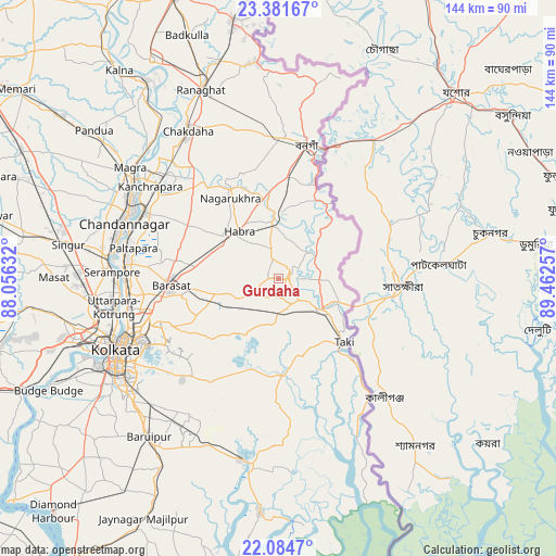
Gurdaha GPS coordinates[2]
22° 44' 4.992" North, 88° 45' 33.984" East
| Map corner | latitude | longitude |
|---|---|---|
| Upper-left | 23.38167°, | 88.05632° |
| Center: | 22.73472°, | 88.75944° |
| Lower-right: | 22.0847°, | 89.46257° |
| Map W x H: | 144.2×144.2 km | = 89.6×89.6mi |
| max Lat: | 34.9274° ⇑50.5% North |
| Gurdaha: | 22.73472° |
| min Lat: | ⇓49.5% South 8.09008° |
| min Long | Gurdaha | max Long |
| 68.82655° | 88.75944° | 96.81° |
| W 94.9%⇐ | ⇒5.1% E |
Elevation
Elevation of Gurdaha is 8 m = 26 ft, and this is 287.6 m = 944 ft below average elevation for this country.
| Max E: |
3681 m = 12077 ft | 98.3% |
| Avg. | 295.6 m = 970 ft | |
| Gurdaha | 8 m = 26 ft | |
Min E: |
1 m = 3 ft | 1.7% |
See also: India elevation on elevation.city.
Geographical zone
Gurdaha is located in North Torrid zone (between Equator and Tropic of Cancer). Distance of this Northern Tropic circle is 78.1 km =48.5 mi to North.| Distance of | km | miles | from Gurdaha |
|---|---|---|---|
| North Pole | 7479.2 | 4647.4 | to North |
| Arctic Circle | 4873.3 | 3028.1 | to North |
| Tropic Cancer | 78.1 | 48.5 | to North |
| Equator | 2527.9 | 1570.8 | to South |


Nearby cities:
15 places around Gurdaha: (largest is in red/bold)
• Ashoknagar Kalyangarh
19.1 km =11.9 mi,  318°
318°
• Badūria
3 km =1.9 mi,  69°
69°
• Bangaon
35.3 km =21.9 mi,  11°
11°
• Bārāsat
28.5 km =17.7 mi,  267°
267°
• Dam Dam
36.3 km =22.6 mi,  251°
251°
• Gobārdānga
15.9 km =9.9 mi,  358°
358°
• Gopālpur
13 km =8.1 mi,  183°
183°
• Haringhāta
31.8 km =19.8 mi, 323°
• Hābra
16 km =9.9 mi, 318°
• Madhyamgram
32.5 km =20.2 mi,  261°
261°
• Nagarukhra
26.1 km =16.2 mi,  331°
331°
• Rāmchandrapur
34.2 km =21.3 mi,  301°
301°
• Sankarpur
34 km =21.1 mi,  291°
291°
• Tāki
24.1 km =15 mi,  132°
132°
• Ula
21 km =13 mi, 266°
Sources, notices
• [Note1] Compared only with cities in India existing in our database
• [Src1] Map data: © OpenStreetMap contributors (CC-BY-SA)
• [Src2] Other city data from geonames.org with taken over terms of usage.
• [Src3] Geographical zone / Annual Mean Temperature by Robert A. Rohde @ Wikipedia
