Fatehgarh geodata
Fatehgarh (Uttar Pradesh) is a populated place; located in India in Asia/Kolkata (GMT+5.5) time zone. With population of 14,847 people, there are 2479 cities with bigger population in this country. Compared to other cities in India, 81% of cities are located further ↓South; 64.9% of cities are located further ←West and 59.1% of cities have higher elevation than Fatehgarh. Note1


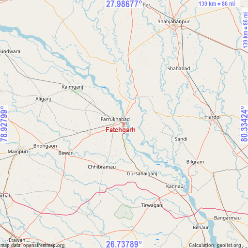
Fatehgarh GPS coordinates[2]
27° 21' 50.724" North, 79° 37' 51.996" East
| Map corner | latitude | longitude |
|---|---|---|
| Upper-left | 27.98677°, | 78.92799° |
| Center: | 27.36409°, | 79.63111° |
| Lower-right: | 26.73789°, | 80.33424° |
| Map W x H: | 138.9×138.9 km | = 86.3×86.3mi |
| max Lat: | 34.9274° ⇑19% North |
| Fatehgarh: | 27.36409° |
| min Lat: | ⇓81% South 8.09008° |
| min Long | Fatehgarh | max Long |
| 68.82655° | 79.63111° | 96.81° |
| W 64.9%⇐ | ⇒35.1% E |
Elevation
Elevation of Fatehgarh is 153 m = 502 ft, and this is 142.6 m = 468 ft below average elevation for this country.
| Max E: |
3681 m = 12077 ft | 59.1% |
| Avg. | 295.6 m = 970 ft | |
| Fatehgarh | 153 m = 502 ft | |
Min E: |
1 m = 3 ft | 40.9% |
See also: India elevation on elevation.city.
Geographical zone
Fatehgarh is located in North temperate zone (between Tropic of Cancer and the Arctic Circle). Distance of this Northern Tropic circle is 436.7 km =271.4 mi to South.| Distance of | km | miles | from Fatehgarh |
|---|---|---|---|
| North Pole | 6964.5 | 4327.5 | to North |
| Arctic Circle | 4358.6 | 2708.3 | to North |
| Tropic Cancer | 436.7 | 271.4 | to South |
| Equator | 3042.6 | 1890.6 | to South |


Nearby cities:
15 places around Fatehgarh: (largest is in red/bold)
• Allāhganj
20.9 km =13 mi,  15°
15°
• Bewar
36.7 km =22.8 mi,  243°
243°
• Chhibrāmau
27.2 km =16.9 mi,  208°
208°
• Farrukhābād
5.9 km =3.7 mi,  300°
300°
• Gursahāiganj
29.4 km =18.3 mi,  160°
160°
• Jalālābād
40.3 km =25 mi,  3°
3°
• Kaimganj
36.1 km =22.4 mi,  305°
305°
• Kamalganj
11.4 km =7.1 mi,  179°
179°
• Kannauj
44.6 km =27.7 mi,  140°
140°
• Muhammadābād
20.6 km =12.8 mi,  252°
252°
• Saurikh
39.7 km =24.7 mi,  200°
200°
• Shamsābād
27.1 km =16.8 mi,  315°
315°
• Shāhābād
43.5 km =27 mi,  44°
44°
• Sāndi
32.8 km =20.4 mi,  104°
104°
• Tālgrām
35.2 km =21.9 mi, 177°
Sources, notices
• [Note1] Compared only with cities in India existing in our database
• [Src1] Map data: © OpenStreetMap contributors (CC-BY-SA)
• [Src2] Other city data from geonames.org with taken over terms of usage.
• [Src3] Geographical zone / Annual Mean Temperature by Robert A. Rohde @ Wikipedia
