Muhammadābād geodata
Muhammadābād (Uttar Pradesh) is a populated place; located in India in Asia/Kolkata (GMT+5.5) time zone. With population of 22,151 people, there are 1894 cities with bigger population in this country. Compared to other cities in India, 80.8% of cities are located further ↓South; 63% of cities are located further ←West and 59.1% of cities have higher elevation than Muhammadābād. Note1


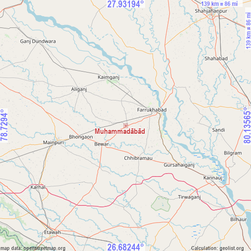
Muhammadābād GPS coordinates[2]
27° 18' 32.22" North, 79° 25' 57.072" East
| Map corner | latitude | longitude |
|---|---|---|
| Upper-left | 27.93194°, | 78.7294° |
| Center: | 27.30895°, | 79.43252° |
| Lower-right: | 26.68244°, | 80.13565° |
| Map W x H: | 138.9×138.9 km | = 86.3×86.3mi |
| max Lat: | 34.9274° ⇑19.2% North |
| Muhammadābād: | 27.30895° |
| min Lat: | ⇓80.8% South 8.09008° |
| min Long | Muhammadābād | max Long |
| 68.82655° | 79.43252° | 96.81° |
| W 63%⇐ | ⇒37% E |
Elevation
Elevation of Muhammadābād is 153 m = 502 ft, and this is 142.6 m = 468 ft below average elevation for this country.
| Max E: |
3681 m = 12077 ft | 59.1% |
| Avg. | 295.6 m = 970 ft | |
| Muhammadābād | 153 m = 502 ft | |
Min E: |
1 m = 3 ft | 40.9% |
See also: India elevation on elevation.city.
Geographical zone
Muhammadābād is located in North temperate zone (between Tropic of Cancer and the Arctic Circle). Distance of this Northern Tropic circle is 430.6 km =267.6 mi to South.| Distance of | km | miles | from Muhammadābād |
|---|---|---|---|
| North Pole | 6970.6 | 4331.3 | to North |
| Arctic Circle | 4364.7 | 2712.1 | to North |
| Tropic Cancer | 430.6 | 267.6 | to South |
| Equator | 3036.5 | 1886.8 | to South |


Nearby cities:
15 places around Muhammadābād: (largest is in red/bold)
• Allāhganj
36.4 km =22.6 mi,  43°
43°
• Alīganj
33 km =20.5 mi,  308°
308°
• Bewar
16.7 km =10.4 mi,  233°
233°
• Bhongaon
25.5 km =15.8 mi,  256°
256°
• Chhibrāmau
19.1 km =11.9 mi,  159°
159°
• Farrukhābād
17.1 km =10.6 mi,  57°
57°
• Fatehgarh
20.6 km =12.8 mi,  72°
72°
• Gursahāiganj
36.6 km =22.7 mi,  126°
126°
• Kaimganj
28.9 km =18 mi,  340°
340°
• Kamalganj
20.3 km =12.6 mi,  104°
104°
• Kampil
37.1 km =23.1 mi, 335°
• Kishni
35.8 km =22.2 mi,  208°
208°
• Saurikh
31.4 km =19.5 mi,  169°
169°
• Shamsābād
25.4 km =15.8 mi,  1°
1°
• Tālgrām
36.1 km =22.4 mi,  143°
143°
Sources, notices
• [Note1] Compared only with cities in India existing in our database
• [Src1] Map data: © OpenStreetMap contributors (CC-BY-SA)
• [Src2] Other city data from geonames.org with taken over terms of usage.
• [Src3] Geographical zone / Annual Mean Temperature by Robert A. Rohde @ Wikipedia
