Saurikh geodata
Saurikh (Uttar Pradesh) is a populated place; located in India in Asia/Kolkata (GMT+5.5) time zone. With population of 12,055 people, there are 2732 cities with bigger population in this country. Compared to other cities in India, 78.6% of cities are located further ↓South; 63.6% of cities are located further ←West and 59.6% of cities have higher elevation than Saurikh. Note1


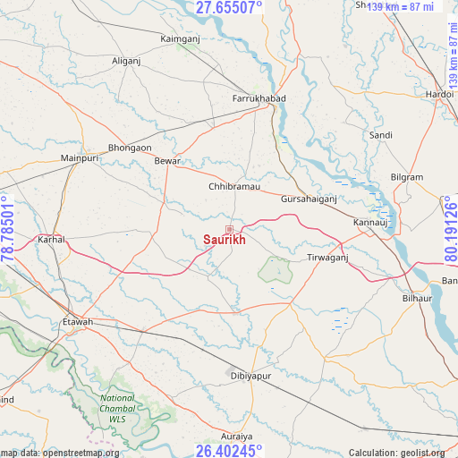
Saurikh GPS coordinates[2]
27° 1' 49.836" North, 79° 29' 17.268" East
| Map corner | latitude | longitude |
|---|---|---|
| Upper-left | 27.65507°, | 78.78501° |
| Center: | 27.03051°, | 79.48813° |
| Lower-right: | 26.40245°, | 80.19126° |
| Map W x H: | 139.3×139.3 km | = 86.6×86.6mi |
| max Lat: | 34.9274° ⇑21.4% North |
| Saurikh: | 27.03051° |
| min Lat: | ⇓78.6% South 8.09008° |
| min Long | Saurikh | max Long |
| 68.82655° | 79.48813° | 96.81° |
| W 63.6%⇐ | ⇒36.4% E |
Elevation
Elevation of Saurikh is 150 m = 492 ft, and this is 145.6 m = 478 ft below average elevation for this country.
| Max E: |
3681 m = 12077 ft | 59.6% |
| Avg. | 295.6 m = 970 ft | |
| Saurikh | 150 m = 492 ft | |
Min E: |
1 m = 3 ft | 40.4% |
See also: India elevation on elevation.city.
Geographical zone
Saurikh is located in North temperate zone (between Tropic of Cancer and the Arctic Circle). Distance of this Northern Tropic circle is 399.6 km =248.3 mi to South.| Distance of | km | miles | from Saurikh |
|---|---|---|---|
| North Pole | 7001.6 | 4350.6 | to North |
| Arctic Circle | 4395.7 | 2731.4 | to North |
| Tropic Cancer | 399.6 | 248.3 | to South |
| Equator | 3005.5 | 1867.5 | to South |


Nearby cities:
15 places around Saurikh: (largest is in red/bold)
• Bewar
28.2 km =17.5 mi,  317°
317°
• Bharthana
40.7 km =25.3 mi,  220°
220°
• Bhongaon
39.3 km =24.4 mi,  309°
309°
• Bidhūna
25.5 km =15.8 mi,  175°
175°
• Chhibrāmau
13.2 km =8.2 mi,  5°
5°
• Farrukhābād
41.1 km =25.5 mi, 12°
• Fatehgarh
39.7 km =24.7 mi,  20°
20°
• Gursahāiganj
25.9 km =16.1 mi,  68°
68°
• Indergarh
21 km =13 mi,  120°
120°
• Kamalganj
29.4 km =18.3 mi,  28°
28°
• Kannauj
42.7 km =26.5 mi,  86°
86°
• Kishni
22.4 km =13.9 mi,  268°
268°
• Muhammadābād
31.4 km =19.5 mi,  349°
349°
• Nagla Panchi
37.5 km =23.3 mi,  284°
284°
• Tālgrām
16 km =9.9 mi,  83°
83°
Sources, notices
• [Note1] Compared only with cities in India existing in our database
• [Src1] Map data: © OpenStreetMap contributors (CC-BY-SA)
• [Src2] Other city data from geonames.org with taken over terms of usage.
• [Src3] Geographical zone / Annual Mean Temperature by Robert A. Rohde @ Wikipedia
