Chorhat geodata
Chorhat (Madhya Pradesh) is a populated place; located in India in Asia/Kolkata (GMT+5.5) time zone. With population of 14,101 people, there are 2552 cities with bigger population in this country. Compared to other cities in India, 60.3% of cities are located further ↓South; 75.4% of cities are located further ←West and 65.7% of cities have lower elevation than Chorhat. Note1


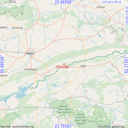
Chorhat GPS coordinates[2]
24° 25' 38.748" North, 81° 40' 10.128" East
| Map corner | latitude | longitude |
|---|---|---|
| Upper-left | 25.06598°, | 80.96636° |
| Center: | 24.42743°, | 81.66948° |
| Lower-right: | 23.78563°, | 82.37261° |
| Map W x H: | 142.4×142.4 km | = 88.5×88.5mi |
| max Lat: | 34.9274° ⇑39.7% North |
| Chorhat: | 24.42743° |
| min Lat: | ⇓60.3% South 8.09008° |
| min Long | Chorhat | max Long |
| 68.82655° | 81.66948° | 96.81° |
| W 75.4%⇐ | ⇒24.6% E |
Elevation
Elevation of Chorhat is 291 m = 955 ft, and this is 4.6 m = 15 ft below average elevation for this country.
| Max E: |
3681 m = 12077 ft | 34.3% |
| Avg. | 295.6 m = 970 ft | |
| Chorhat | 291 m = 955 ft | |
Min E: |
1 m = 3 ft | 65.7% |
See also: India elevation on elevation.city.
Geographical zone
Chorhat is located in North temperate zone (between Tropic of Cancer and the Arctic Circle). Distance of this Northern Tropic circle is 110.2 km =68.5 mi to South.| Distance of | km | miles | from Chorhat |
|---|---|---|---|
| North Pole | 7291 | 4530.4 | to North |
| Arctic Circle | 4685.1 | 2911.2 | to North |
| Tropic Cancer | 110.2 | 68.5 | to South |
| Equator | 2716.1 | 1687.7 | to South |


Nearby cities:
15 places around Chorhat: (largest is in red/bold)
• Amarpātan
71.3 km =44.3 mi,  259°
259°
• Baikunthpur
42.5 km =26.4 mi,  321°
321°
• Beohāri
53.7 km =33.4 mi,  213°
213°
• Govindgarh
38.2 km =23.7 mi, 261°
• Gurh
19 km =11.8 mi,  296°
296°
• Kotwa
75.8 km =47.1 mi,  332°
332°
• Mangawān
29.5 km =18.3 mi,  335°
335°
• Mauganj
33.7 km =20.9 mi,  37°
37°
• Naīgarhi
41.5 km =25.8 mi,  15°
15°
• Rewa
39.9 km =24.8 mi,  287°
287°
• Sidhi
21.4 km =13.3 mi,  97°
97°
• Simaria
66.4 km =41.3 mi,  307°
307°
• Sirmaur
54.9 km =34.1 mi, 325°
• Sohāgi
61.7 km =38.3 mi,  2°
2°
• Teonthar
61.7 km =38.3 mi,  357°
357°
Sources, notices
• [Note1] Compared only with cities in India existing in our database
• [Src1] Map data: © OpenStreetMap contributors (CC-BY-SA)
• [Src2] Other city data from geonames.org with taken over terms of usage.
• [Src3] Geographical zone / Annual Mean Temperature by Robert A. Rohde @ Wikipedia
