Sohāgi geodata
Sohāgi (Madhya Pradesh) is a populated place; located in India in Asia/Kolkata (GMT+5.5) time zone. With population of 9,009 people, there are 3033 cities with bigger population in this country. Compared to other cities in India, 63.3% of cities are located further ↓South; 75.5% of cities are located further ←West and 65.6% of cities have higher elevation than Sohāgi. Note1


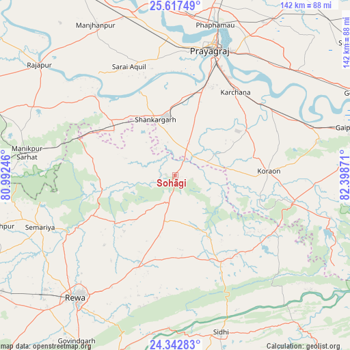
Sohāgi GPS coordinates[2]
24° 58' 54.516" North, 81° 41' 44.088" East
| Map corner | latitude | longitude |
|---|---|---|
| Upper-left | 25.61749°, | 80.99246° |
| Center: | 24.98181°, | 81.69558° |
| Lower-right: | 24.34283°, | 82.39871° |
| Map W x H: | 141.7×141.7 km | = 88×88mi |
| max Lat: | 34.9274° ⇑36.7% North |
| Sohāgi: | 24.98181° |
| min Lat: | ⇓63.3% South 8.09008° |
| min Long | Sohāgi | max Long |
| 68.82655° | 81.69558° | 96.81° |
| W 75.5%⇐ | ⇒24.5% E |
Elevation
Elevation of Sohāgi is 116 m = 381 ft, and this is 179.6 m = 589 ft below average elevation for this country.
| Max E: |
3681 m = 12077 ft | 65.6% |
| Avg. | 295.6 m = 970 ft | |
| Sohāgi | 116 m = 381 ft | |
Min E: |
1 m = 3 ft | 34.4% |
See also: India elevation on elevation.city.
Geographical zone
Sohāgi is located in North temperate zone (between Tropic of Cancer and the Arctic Circle). Distance of this Northern Tropic circle is 171.8 km =106.8 mi to South.| Distance of | km | miles | from Sohāgi |
|---|---|---|---|
| North Pole | 7229.3 | 4492.1 | to North |
| Arctic Circle | 4623.5 | 2872.9 | to North |
| Tropic Cancer | 171.8 | 106.8 | to South |
| Equator | 2777.7 | 1726 | to South |


Nearby cities:
15 places around Sohāgi: (largest is in red/bold)
• Allahābād
53.6 km =33.3 mi,  16°
16°
• Baikunthpur
40.4 km =25.1 mi,  225°
225°
• Chail
49.9 km =31 mi,  352°
352°
• Gurh
56.8 km =35.3 mi,  200°
200°
• Jhūsi
54.9 km =34.1 mi, 22°
• Kotwa
38.3 km =23.8 mi,  278°
278°
• Mangawān
38 km =23.6 mi, 203°
• Mauganj
39.3 km =24.4 mi,  152°
152°
• Naīgarhi
23.2 km =14.4 mi,  158°
158°
• Sarāi Ākil
47.9 km =29.8 mi,  337°
337°
• Shankargarh
23.6 km =14.7 mi, 340°
• Simaria
58.6 km =36.4 mi,  249°
249°
• Sirmaur
37.1 km =23.1 mi,  244°
244°
• Sirsā
50.7 km =31.5 mi,  51°
51°
• Teonthar
5.4 km =3.4 mi,  270°
270°
Sources, notices
• [Note1] Compared only with cities in India existing in our database
• [Src1] Map data: © OpenStreetMap contributors (CC-BY-SA)
• [Src2] Other city data from geonames.org with taken over terms of usage.
• [Src3] Geographical zone / Annual Mean Temperature by Robert A. Rohde @ Wikipedia
